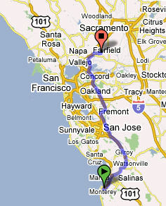
Day 84 Thursday, May 24 2007
Nashville, TN
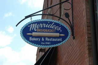
Well, we decided to stay another day in and around Nashville. We wanted to look around a little downtown and also take a look at an area that our neighbour at home in Woodbridge had recommended, the town of Franklin outside and south of Nashville. The small town was delightful and we had lunch at the local bakery. Yum! We love it when we find little Gems like this on our trip.
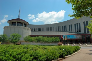
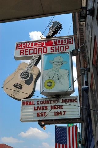
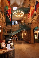
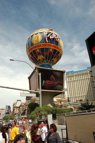
We visited the Music Hall of Fame in Nashville,
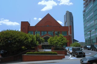
as well as the “old” Grand Ole Opry downtown.
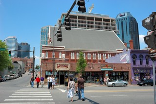
We found Nashville a very modern city with lots of places to sit and enjoy the country music piped in over the loudspeakers.
Around the town square little stalls were set up selling organic vegetables, breads, meats and cheeses, even organic dyed clothing. Way to go Nashville!
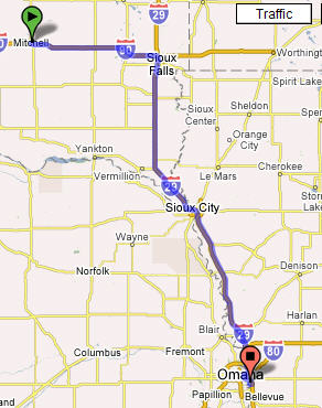
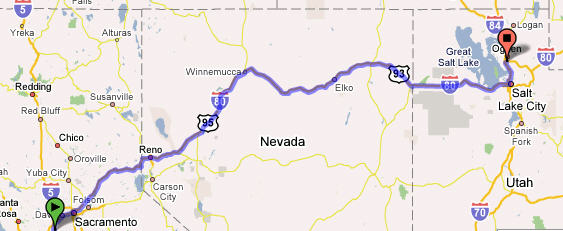
Day 83 Wednesday, May 23, 2007
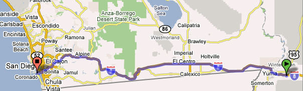
Scott AFB, Ill to Nashville, TN – 301 Miles
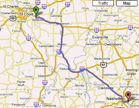
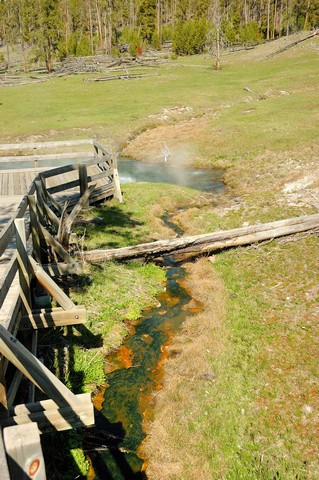
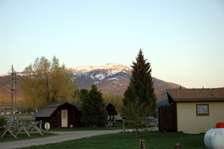
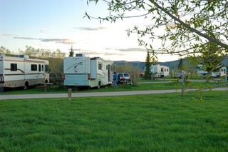
This morning we got up early and headed out southeast to Nashville, Tn. We arrived at a Corps of Engineers campground (Seven Points Public Use Area) shortly after 2:30pm today; we set up the RV and then took a nap after another long day of driving. Later this evening we took Lucy for a long walk.
Tomorrow we’ll decide if we’ll drive on or spend a day in and around Nashville. We’re trying to get to Columbia, SC for the Memorial Day week-end; my sister and brother-in-law have a small place on Lake Murray just outside Columbia.
Day 81 & 82 Monday, May 21 and Tuesday, May 22, 2007
Scott AFB, Il FamCamp
This morning we noticed that we had voice mail from yesterday. After checking we found that one of the calls was from one of the bikers who called to tell us that they looked all over for Lucy and even stopped a “blue van” to check to see if Lucy was on board. They just wanted to follow up to tell us of their search and hoped we had found her. The other call was from the BP Gas Station clerk who noted that Lucy had wandered into the store and that they had served her some ice water and just wanted us to know where she was. Both calls reminded us that people do care for others and this made us feel good and thankful.
We spent the last couple days at Scott AFB resting and re stocking for the continued trip. Sylvia made several calls to tire dealers including Sams and Costco to check on tire availability and found that in all cases we would have to wait 3–5 business days for delivery; this meant we were dead in the water since we did not want to take the chance of driving without a spare. Someone suggested I check with the base exchange to see what they could do; I did and I found they could get us the tire the next day. Hooray for the base exchange! We think we’ve had our quota of tire incidents….
Day 80 Sunday, May 20, 2007
Platte City, Missouri to Scott AFB, Ill – 300+ Miles (via a Maifest in Hermann, Missouri)
Today we headed out for Scott AFB just east of St Louis, Missouri. However, we did make a slight detour to stop by a Maifest in Hermann, Missouri. This detour proved to be stressful initially and then interesting later.
En route to Hermann we came to a very narrow bridge that crossed the Missouri River into Hermann. I took the call and went to scout the bridge and determined that it would be very tight driving the RV over it with the very narrow lanes and the on coming traffic to be concerned about. So, rather than risk an incident, we decided to park the RV at a gas station, unhook the car and just drive the Honda over the bridge to the Maifest. This is when the stress really kicked into high gear… We had just rearranged things in the Honda putting down a blanket in the back seat for Lucy when we discovered that Lucy was missing and no where to be found!!!!!!!! Sylvia was in a frantic state of mind now… she told me that she had noticed a blue van that stopped in the parking lot near the RV; a man got out and opened the sliding rear door and a short time later drove off! After whistling and looking frantically for Lucy we quickly came to the conclusion that this guy in the blue van had dog napped Lucy and we were in a major panic to say the least! There was a motorcycle club group leaving the gas station… Sylvia quickly stopped them explaining the situation and they said they would look for the “blue van” along the route they were traveling and if they found it would check to see if Lucy could be found; so, off they went.
Sylvia and I continued to look all over for Lucy…. Finally after us almost giving up, Lucy came out from behind the gas station with her head down and tail between her legs! She knew she was in trouble; however, we were so glad to see her that we totally did not want to scold her for her wandering off. It just drove home the point that we have to be more careful when we let Lucy out of the RV…. There are a lot of strange people out there who would think nothing of stealing our sweet Lucy dog.
After we calmed down, Sylvia and I and Lucy drove over that narrow bridge and went to the Maifest in Hermann. We walked the town and had some wine and ate dinner at one of the Wineries. This was very enjoyable and reminded us of our times in Germany going to winefests.
Later we drove on to Scott AFB, another 100 miles or so, set up in the camp ground and made it an early night.
Day 79 Saturday, May 19, 2007
Council Bluffs, Iowa to Platte City, Missouri -156 Miles
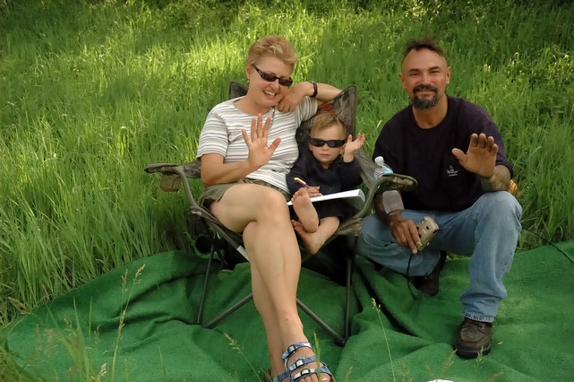
Wow, what an exciting day today. We had intended to drive a bit over 250 miles and stay at a campground somewhere east of Kansas City, Mo; however, about 80 miles south of Council Bluffs we experienced our first BLOWOUT! As I was driving down I-29 I came down a hill and at the bottom of the dip the left rear inside dual tire blew!!!!! I was able to maintain control pulling to the side of the road at the top of the hill. I called our friendly road service and then we proceeded to wait for the next 2 hours for them to arrive to change our tire! Sylvia and I just got our camping chairs out and our artificial carpet out and set them up in the grass and watch the cars and trucks roll by.
A good samaritan stopped to see if we were OK and if they could help. Johnny and his 2–year old son Cash hung out with us and kept us company as we waited for the service to arrive.
The Service did finally get a truck out and the nice fellow changed out our tire. You might recall that early on in our trip we had a flat tire with we had apparently run over a nail. This was quite different and very dangerous with the tire just blowing out. It did do a little damage to the wheel well but nothing that will keep us from moving on down the road; we repair this minor damage once we complete our trip.
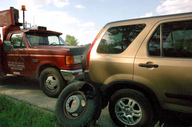
You can see in the photo above the big hole in the tire the blew!
After the repair/tire change we drove on to find the nearest campground to camp for the night and decompress after this stressful incident!
Oh, tomorrow’s another day in our adventure.
Day 78 Friday, May 18, 2007
Mitchell, SD to Lake Manawa, Council Bluffs, Iowa – 256 Miles
Today we drove south and east to outside Omaha, Nebraska and Council Bluffs, Iowa. We found a Iowa State Park campground at Lake Manawa and stayed there for the night.
Day 77 Thursday, May 17
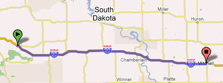
Ellsworth AFB, SD to Mitchell, SD via Wall Drug and the Badlands National Park – Miles
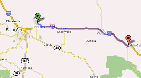
Today we started our trip south and east by drive I-90 to Wall SD where were stopped by the famous Wall Drug Store. Wall Drug was bought by the Husteads in December 1931. Just after the depression they were trying to make a go of it but it was very difficult. They came upon a idea several years later to put up signs along the interstate advertising free ice water and since then everything else is history. Mr. Hustead has said: “Free Ice Water. It brought us Husteads a long way and it taught me my greatest lesson, and that's that there's absolutely no place on God's earth that's Godforsaken. No matter where you live, you can succeed, because wherever you are, you can reach out to other people with something that they need!”
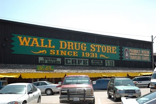
 You can visit their web site at: http://www.walldrug.com
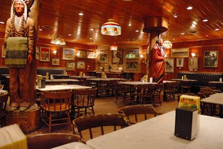
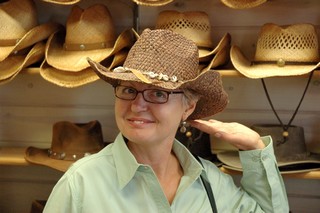
How do you like Sylvia’s new hat?
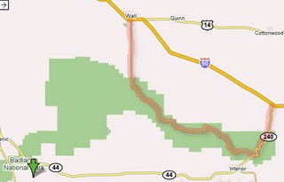
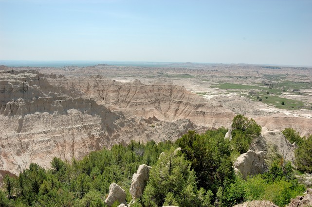
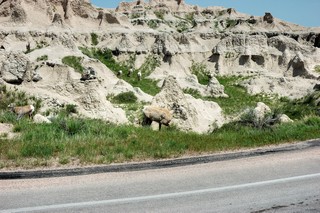
From Wall Drug we drove the loop through the Badlands National Park.
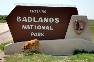
The Badlands National Park was created to preserve the scenic and scientific value of a portion of the White River Badlands for the benefit and enjoyment of the people. Here natural processes have uncovered and displayed a concentrated collection of rutted ravines, serrated towers, pinnacles, and precipitous gulches. The park contains world renowned paleontological features and geological formations of the Eocene and Oligocene epochs with recognized scientific and educational value. This spectacular setting contains a fine example of a vast mixed grass prairie ecosystem. The landscape encompasses an 11,000 year legacy of human use and occupancy. Located in southwestern South Dakota, Badlands National Park consists of nearly 244,000 acres of sharply eroded buttes, pinnacles and spires blended with the largest, protected mixed grass prairie in the United States. Sixty-four thousand acres are designated official wilderness. Established as Badlands National Monument in 1939, the area was redesignated as a National Park in 1978. Over 11,000 years of human history pales to the eons old paleontological resources. Badlands National Park contains the world's richest Oligocene epoch fossil beds, dating 23 to 35 million years old. The evolution of mammal species such as the horse, sheep, rhinoceros and pig can be studied in the Badlands formations.
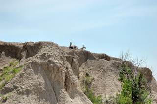
As we started our drive through the park we notice a few of the “locals” sitting up on the hill watching the tourists drive by… We could just hear them saying to each other: “Well Myrtle here’s a couple more and they’re taking pictures like the rest. Check me out, do I have grass in my teeth? Smile for the tourists!”
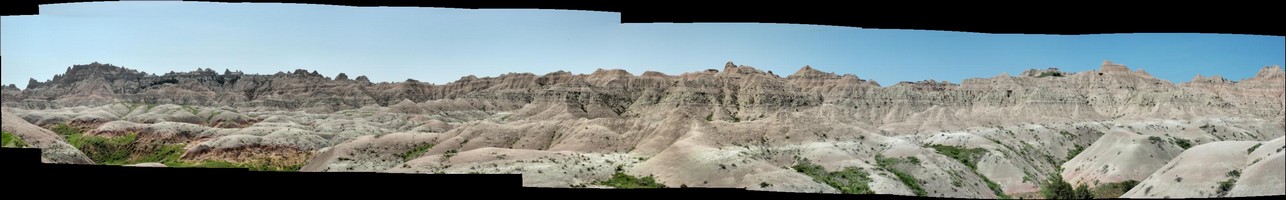
Here’s a panoramic photo made up from 10 photos as I panned and took pictures of the barren wasteland.
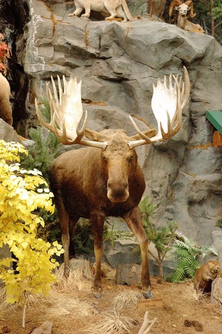
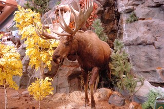
From the Badlands National Park we drove on to Mitchell, SD where we stopped for the night. Before bedding down for the night we went to the Cabella’s Sporting Goods store.
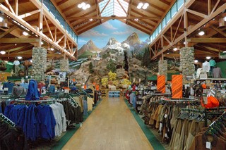
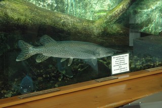
There they had an incredible selection of sporting goods, clothing, etc. We especially like the live fish in the fish tanks and the stuff animals display.
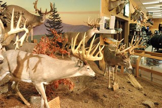
Here we finally got to see a Moose… but unfortunately he was not alive…. someday we’ll see a live one!!
Days 74-76 Monday, May 14 to Wednesday, May 16
Monday, May 14 – Ellsworth AFB, SD
Today we did much of nothing except relax and did a little maintenance on the RV. I went over to the auto hobby shop on base and changed the oil in the RV, it was due. It was really windy and really cool to cold today, so, much of the day we spent inside. Later in the day I took the Honda down to the dealer in Rapid City to have the 50K service done on it as well. Our friends and traveling partners, Andy and Emily, went on down to see Mt Rushmore.
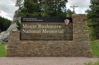
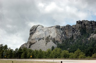
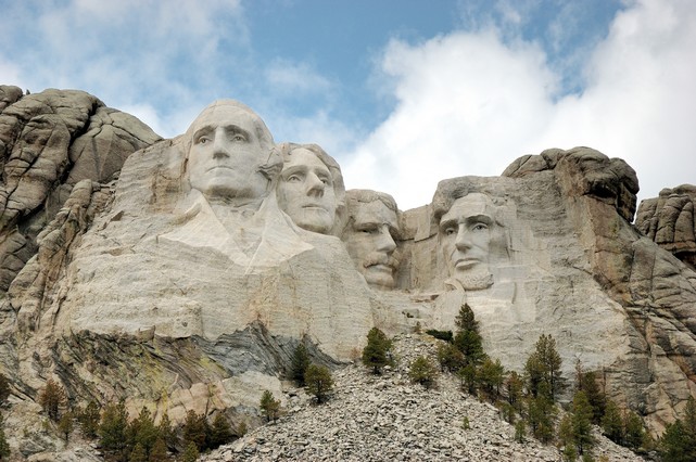
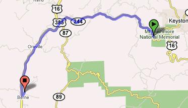
Tuesday, May 15 – Sight seeing to Mt Rushmore and Crazy Horse
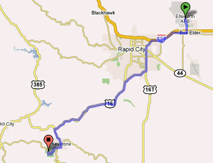
Today we drove the 34 miles south to see the Mt Rushmore National Memorial. It we really quite impressive indeed.
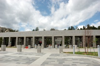
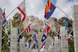
Here’s the entrance and the “hall of flags” leading to the memorial.
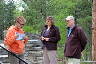
While walking the path through the memorial we ran in to the German couple that we had seen in Yellowstone when we stopped beside the road to see the animals. What a small world for us to have run into this couple again a couple states away and a week or so later!!
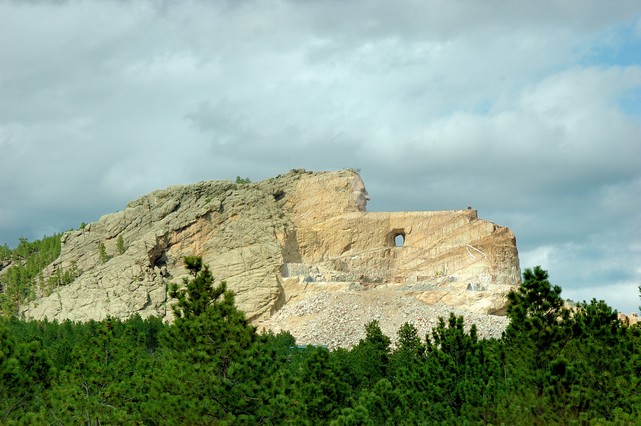
After visiting Mt Rushmore we drove about 14 miles further south to see the Crazy Horse Memorial.
Sculptor Korczak Ziolkowski and Lakota Chief Henry Standing Bear officially started Crazy Horse Memorial June 3, 1948. The Memorial's mission is to honor the culture, tradition and living heritage of North American Indians. When completed, this will be the largest mountain sculpture in the world. Because of several factors, such as the uncertainty of the weather, the availability of financing and the challenges of the mountain engineering, there is no way to predict a completion date for the mountain carving. When Korczak died on October 20, 1982, his parting words to his wife were, "You must work on the mountain -- but go slowly so you do it right." Crazy Horse Memorial is a project that will never end, even after the mountain carving is complete. The Ziolkowski family and the Crazy Horse Memorial Foundation are dedicated to making careful and steady progress on all of the Memorial's humanitarian goals as well as on the mountain carving. His wife and 7 of his children and their families continue to work on the sculpture today.
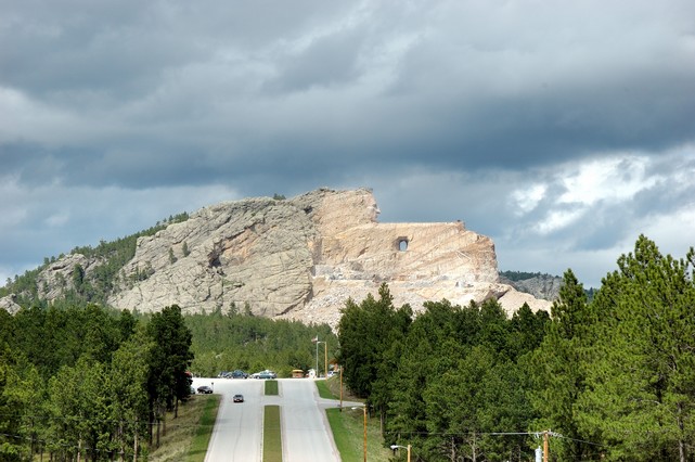
I hope you can see from this picture the magnitude of this work in process. It is already taller than the Washington Monument. When completed the Crazy Horse mountain carving will be 641 feet long by 563 feet high. Crazy Horse's completed head is 87 feet 6 inches high. The horse's head, currently the focus of work on the mountain, is 219 feet or 22 stories high.

The photo on the left shows a model of what the carving will look like when completed. Korczak depicted Crazy Horse with his left hand pointing in answer to the derisive question asked by a white man, "Where are your lands now?" Crazy Horse replied, "My lands are where my dead lie buried. "
The official web site can be visited at:
http://www.crazyhorse.org/
The Web Cam is at:
http://www.crazyhorse.org/webcam.shtml
Wednesday, May 16, 2007
Today we rested and re-stocked the RV for our trip south.
Day 73 Sunday, May 13, 2007 - Mother's Day
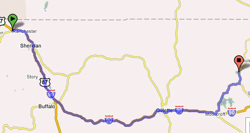
Ranchester, WY to Devils Tower National Monument, WY – 179 Miles
Mother’s day in Ranchester started by us going out for a great Mother’s day breakfast in the one and only diner/restaurant in Ranchester. I guess the single place to eat is what would be expected in the booming town with a population of 701! It was an interesting experience since it was the place were all the locals came in for breakfast each morning and chatted about things going on around the county. We over heard one fellow who came in greet another with something like: “I like those shoes you have on; they look like the ones I have at home.” The other fellow replied with: “Well, that’s what happens when you leave home without them!”
The breakfast special was really great: 6 oz New York Strip, 2 eggs, hash browns, bacon, 2 pancakes all for $6.95. They forgot to mention the hot cakes where the size of dinner plates. Everything tasted great.
While eating we took in the small town USA flavor by listening to some older local fellows bantering with one another and the waitress. The discussions centered around politics, the river rising, where the good fishing is (Walleye)?, and my kind of topic, Indians. Yup Indians – the town borders on the Crow Indian Reservation. They discussed fights breaking out in local bars between whites and Indian fellows. I did hear one comment something to the tune of ”well we took enough away from them, don’t you think”. We were told that the main industry of the town was coal mining and ranching.
While I got the Coach ready to hit the road, Sylvia walked Lucy around town one more time and noted every house having a large Propane tank in their backyard. A local artist decided to turn them in to a piece of art by painting them like a watermelon, bumble bee or caterpillar. Clever!
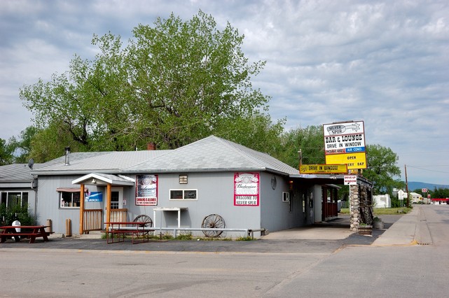
Before leaving Ranchester, SD we had to take a picture of this interesting place; note the sign that says drive-in window… never saw a bar with a drive-in window!!
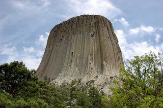
We hit the road and drove a bit over 3 1/2 hours and arrived at Devils Tower, WY. My only familiarity with this place was from it being in the movie “Close Encounters of the Third Kind”. Actually this is a real historic monument.
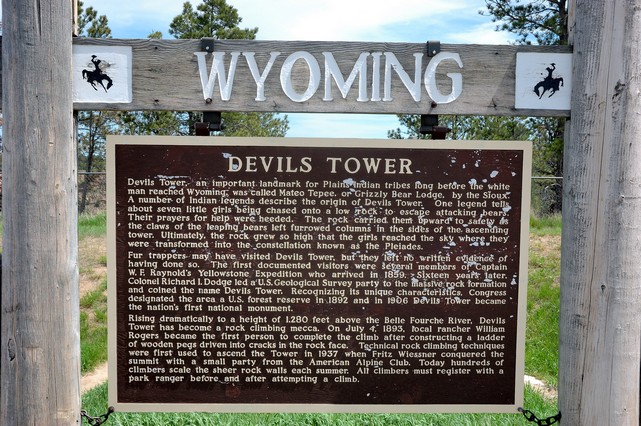
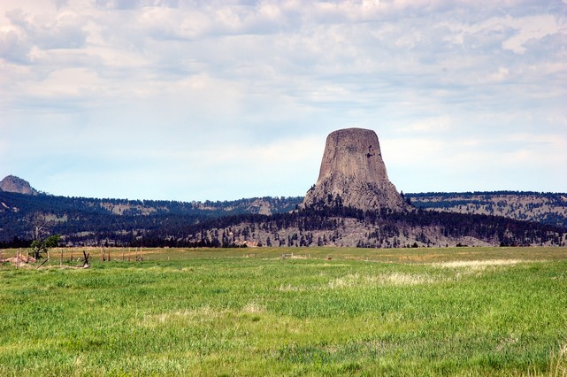
President Theodore Roosevelt established Devils Tower National Monument on September 24, 1906; it was the first national monument. The spectacular rock formation known as Devils Tower and the surrounding countryside, home to a myriad of plant and animal life, attract visitors from around the world. Climbers test their skills on vertical rock walls. Visitors delight in the beauty of the area and enjoy the activities offered at the monument. Also known as Bears Lodge, American Indians consider the area sacred, a place for prayer and renewal. Devils Tower rises 1267 feet above the Belle Fourche River. Once hidden, erosion has revealed Devils Tower. This 1347 acre park is covered with pine forests, woodlands, and grasslands. Deer, prairie dogs, and other wildlife are seen.
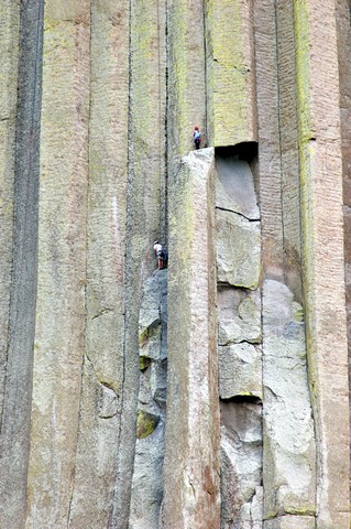
Note the climbers on the photo above!
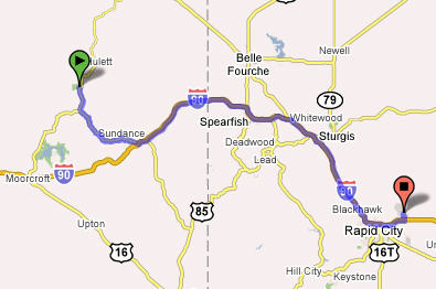
From here we drove on to Ellsworth Air Force Base just outside Rapid City, SD – 115 Miles.
Here we plan to spend several days re-stocking, resting, doing some maintenance and going to see the sites of Mount Rushmore and the Crazy House Monument. You see this information and pictures in my next posting.
Day 72 Saturday, May 12, 2007
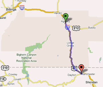
North Yellowstone to Little Bighorn (229 Miles) and to Ranchester, WY (54 Miles)
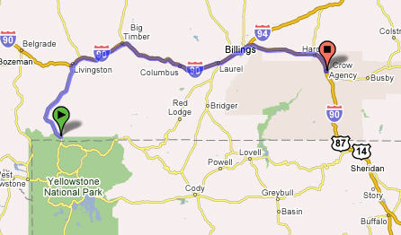
This morning we left the Yellowstone Mammoth Hot Springs campground and drove to Little Bighorn Battlefield Monument just south of Crow Agency, Montana.
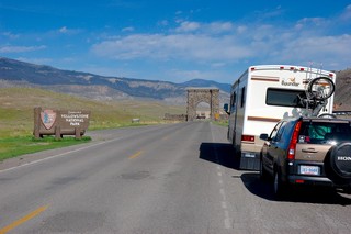
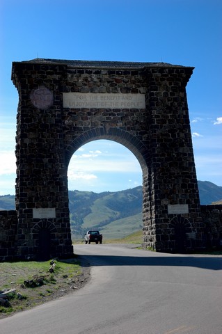
The picture above shows the original North Entrance to Yellowstone built in 1872.
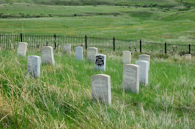
Little Bighorn Battlefield National Monument is the site of the June 25, 1876 battle between the U.S. Army's 7th cavalry and several bands of Dakota Sioux, Cheyenne and Arapaho.
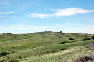
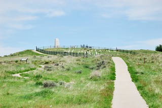
The above pictures are looking up to the top of Little Bighorn where Custer made his last stand. The tombstones you see are markers showing where the last solders fell as they were killed by the Indians.
Little Bighorn Battlefield National Monument near Crow Agency, Montana, commemorates one of America's most significant and famous battles, the Battle of the Little Bighorn. Here on June 25 and 26, 1876, two divergent cultures clashed in a life or death struggle.
Four hundred years of struggle between Euro-Americans and Native Americans culminated on this ground. Like a handful of battles in American history, the defeat of 12 companies of Seventh Cavalry by Lakota (Sioux), Cheyenne, and Arapaho warriors rose beyond its military significance to the level of myth. Thousands of books, magazine articles, performances in film and theater, paintings, and other artistic expressions have memorialized "Custer's Last Stand."
In 1879, the Little Bighorn Battlefield was designated a national cemetery administered by the War Department. In 1881, a memorial was erected on Last Stand Hill, over the mass grave of the Seventh Cavalry soldiers, U.S. Indian Scouts, and other personnel killed in battle. In 1940, jurisdiction of the battlefield was transferred to the National Park Service. These early interpretations were largely mono-cultural, honoring only the U.S. Army's perspective, with headstones marking where each fell.
The essential irony of the Battle of the Little Bighorn is that the victors lost their nomadic way of life after their victory. Unlike Custer's command, the fallen Lakota and Cheyenne warriors were removed by their families, and "buried" in the Native American tradition, in teepees or tree-scaffolds nearby in the Little Bighorn Valley. The story of the battle from the Native American perspective was largely told through the oral tradition.
Even so, today, no memorial honors the Native Americans who struggled to preserve and defend their homeland and traditional way of life. Their heroic sacrifice was never formally recognized - until now.
Here you can see the marker of Custer among the other fallen.
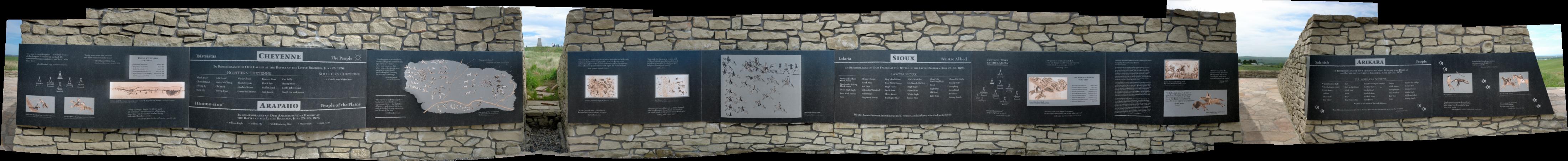
There was also a monument to recognize the Indians who fought and won this battle.
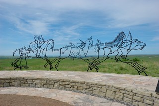
A panoramic of the Indian Memorial is below.
If you’re interested there is a WebCam at the battlefield; the address is below.
Little Bighorn Battlefield WebCams: http://www.nps.gov/libi/photosmultimedia/webcams.htm
From the battlefield we drove another 50 or so miles south into Wyoming to Ranchester where we found a very nice campground for the one night stay before heading out in the morning to see Devils Tower Monument south and east in Wyoming. See tomorrow’s post for the details.
Day 71 Friday, May 11, 2007
North Yellowstone
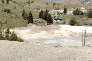
Today, we broke camp at Lionshead RV Park in West Yellowstone and headed out to camp in the park itself at the Mammoth Hot Springs campground up by the North Entrance to Yellowstone. On the map below you can see the yellow route we took through the park to get to the North Yellowstone campground.
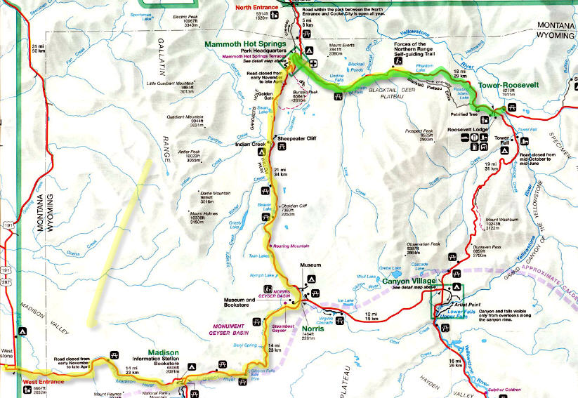
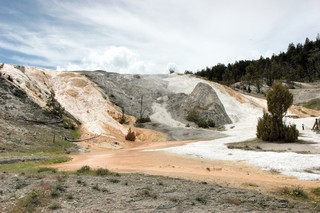
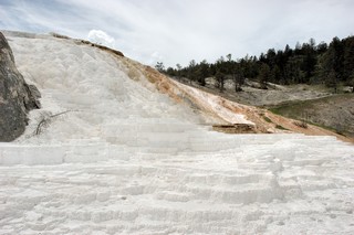
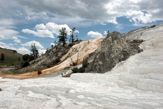
After some lunch we head out to see the Mammoth Hot Springs and the Northern road highlighted in Green on the map above.
There’s a really nice place provided by the National Park Service to take a virtual tour of the springs: http://www.nps.gov/yell/tours/mammoth/index.htm . It really gives a great description of the place and even has a live webcam at: www.nps.gov/yell/mammothcam.htm .
Here are a few of my pictures from our walk around and through the springs.
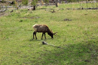
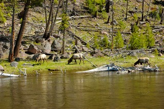
We saw a bunch more Elk along the route but NO MOOSE!! Where are the MOOSE??
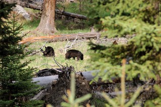
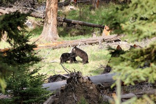
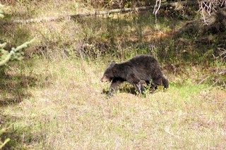
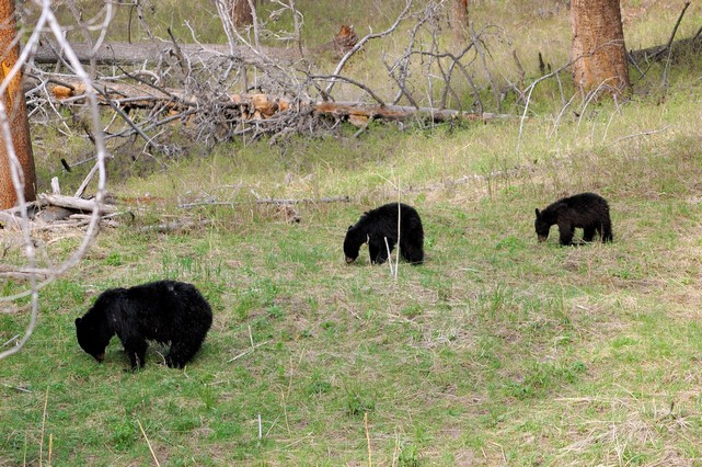
As we drove on we noted that there were a lot of cars stopped and even a park ranger out on the road directing people to park completely off the road. What were they all looking at?? A mama Black Bear and her two cubs.
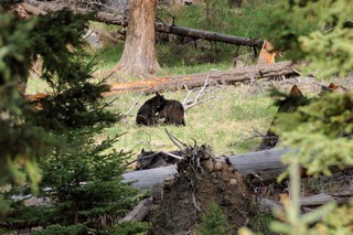
The little guys were playfully fighting in the picture to the right above.
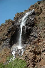
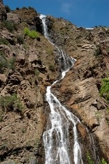
We drove further and found another really great water fall.
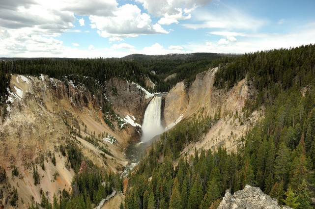
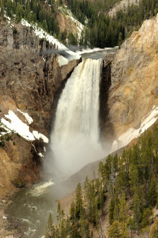
Day 70, Thursday, May 10, 2007
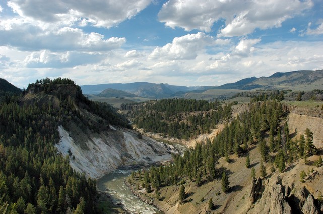
The Grand Canyon of the Yellowstone
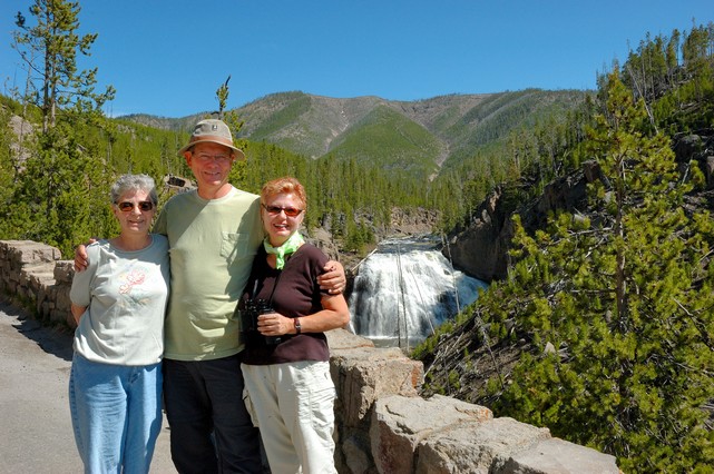
This morning we were up and out of our campground to see the Grand Canyon of Yellowstone, waterfalls and, of course, more animals with our traveling partners, Emily and Andy. We still need to see a Moose!
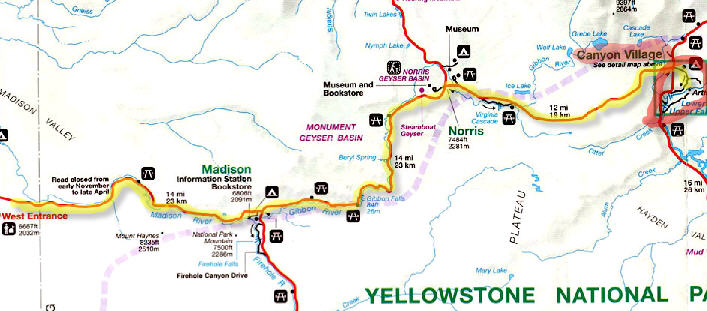
We entered at the West Entrance on the picture above and traveled on a 30 mile route to take us to the canyon. Our first stop was to see another hot springs in the Monument Geyser Basin.
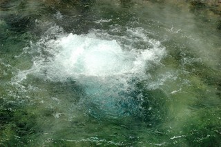
It’s a little hard to tell in the left picture above but the water was super clear and right below the main bubbling water the color was a beautiful aqua-marine color.
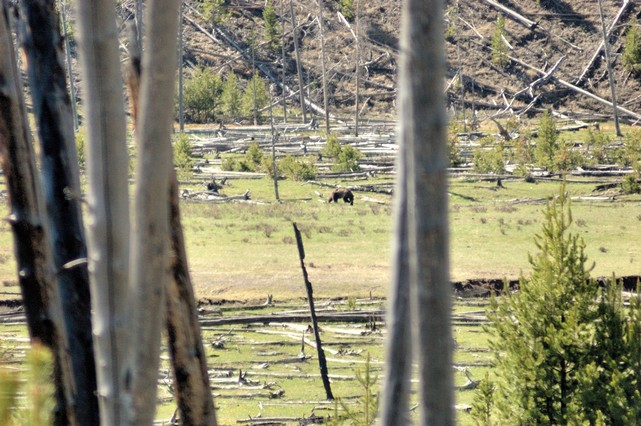
We were on our “Moose Watch” and came across a Grizzly Bear in the distance and were happy he was at a distance.
Next stop was at Gibbon Falls.
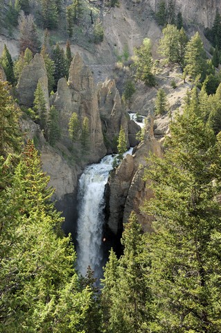
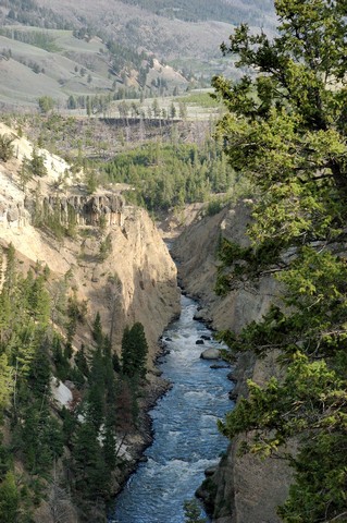
Last stop for the day was the Grand Canyon of the Yellowstone.
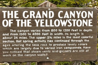
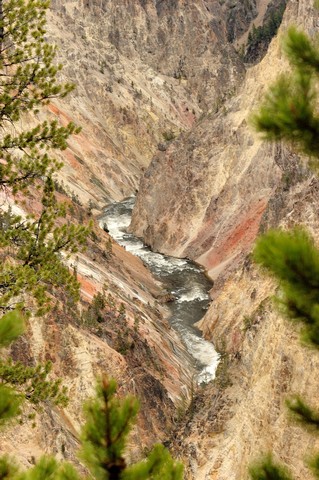
The canyon had a magnificent waterfall in it where the water dropped more than 380 feet, a much larger drop than Niagara Falls!
We saw some more buffalo on our way back to the campsite but NO MOOSE!!
Day 69 Wednesday, May 9, 2007
West Yellowstone to Old Faithful in Yellowstone National Park
This morning we got up and checked with our camp host at Lionshead Campground to see if they would keep an eye on Lucy while we headed into the park. We had found out previously that National Parks are not pet friendly since they are concerned with pets possibly chasing wild animals.
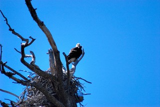
We headed into the park and right off the start Emily spotted a Eagle sitting on its nest.
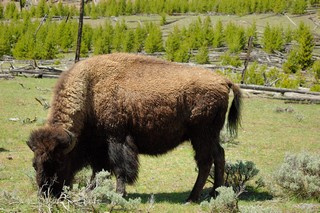
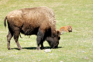
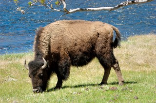
There were abundant Buffalo roaming around freely. Their gentle nature can be misleading as several tourists have been gored when they came too close to them. They weigh upward to 2000lb and can run 30 miles an hour (3 times faster than humans). OK got it! Do not get too close! We saw new babies less than a week old hanging out with mama.
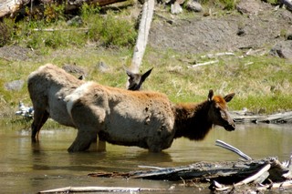
We next came upon a few Elk grazing across the river.
Not far from the eagles nest we spotted something moving in the woods…. a gray/white wolf..awesome. I came eye to eye with a gray wolf (via binoculars). His eyes where gray blue and totally mesmerizing. I swear he looked right at me, it gave me chills. It just made our whole day.
Later on we came across a Grizzly, again via binocular. Before today I though of bear as rather large animals heavy on their feet swathing a things somewhat comical. I now have total respect for the animal, for all it size it moved deliberately and gracefully full of power and purpose. According to a Ranger, Grizzles used to be common in all 48 states, they are now relegated to mainly the western mountain states with numbers ranging in the 1200. Ask if it is the most dangerous animal in the park, he replied the most dangerous animal in this park has two legs and comes with 4 tires. Point taken…be mindful when driving in the park. Still no Moose sightings….
There were many visitors in the park from all over the US and even from Europe. As we drove through the park we would see cars stopped along side of the road and found that was always a good sign that some animal had been spotted. Not unlike rubber necking on 95, you have to pull over as well to be sure to get a look. While pulled over at a particular busy spot where the Grizzly had been sighted I passed our binoculars over to a German couple for them to get a better view of the Grizzly. At the next animal sighting stop when I saw the couple again I had to ask them where they were from; they were from Leipzig, but now living in Munich.
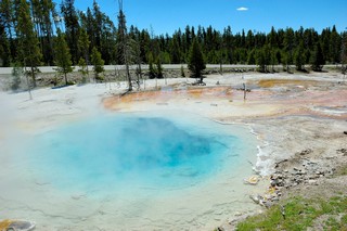
As we drove along we came across the first Geyser Fields and had to stop and walk the board walk to get a closer view of these things.
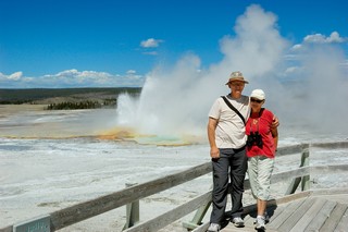
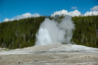
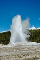
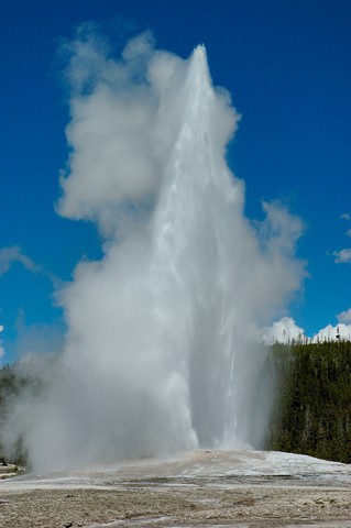
Moving on down the road we came up to the Old Faithful Geyser area. We went into the Visitors Center
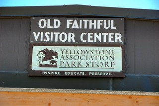
and noted that they had actually posted the time they had predicted the next eruption of the Old Faithful Geyser; we had about 15 minutes to look around before taking our seats at Old Faithful to see the show. As predicted, the eruption took place within a couple minutes of their estimate. A really awesome sight to behold!
Day 68 Tuesday, May 8, 2007
Victor, ID to West Yellowstone, Montana – 103 Miles
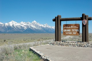
We regretfully had to leave the Grand Tetons behind and headed for West Yellowstone where we would stay for a visit to Yellowstone National Park. West Yellowstone is just outside the west entrance to the park and our campground, Lionshead RV Park was just 7 miles west of West Yellowstone.
Before we hit the road we prepared bacon, eggs, pancakes, strawberries and lots of coffee and sat down with our traveling partners, Andy and Emily, for a wonderful Cowboy style breakfast. On a very sunny and warm day we head out.. on the road again…
On this trip out West we have become very conscious of weather. We found it is very difficult to drive during windy conditions – thunderstorms and such. We’ve heard chances of thunderstorms are on their way on Wednesday so we decided we’d rather be in Yellowstone rather risking another drive in bad weather.
Being at this elevation, around 6000 feet, the air is dry; the sky is clear and the sun is very powerful. After getting sunburned a few times just wearing his OU ball-cap style hat we decided that Richard needed a new hat. That’s right we’re in Cowboy country now… and note the star…. Richard even got deputized(-:
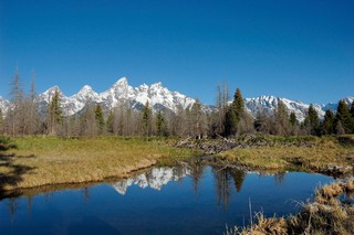
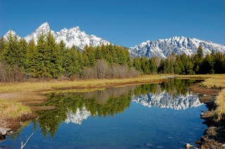
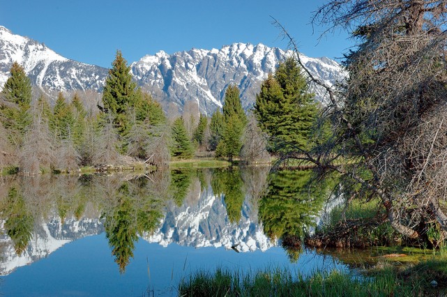
Day 67 Monday, May 7, 2007 Late Morning and Afternoon
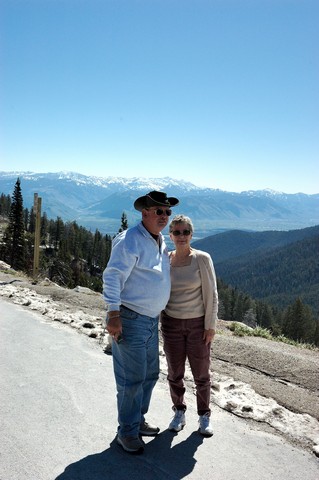
After returning to the campground about 10:00 from my early morning photo shoot all four of us got in the car for a sight seeing trip to Jackson WY and on to see the Snake River (Evil Knivel jumped) and the Tetons.
Here’s our traveling companions, Andy and Emily.
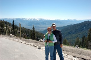
We stopped many times along the way to marvel at the beauty of the landscape and took many pictures. We stopped at Jenny Lake, a mountain lake created by glaciers 200 feet deep and clear as glass.
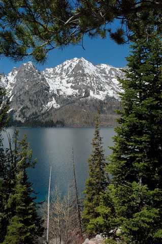
Above, this is a photo of Jenny Lake and next one is of Jackson Lake.
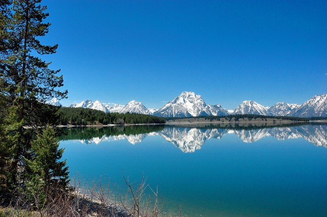
We all wanted to see Eagles, Elk, Buffalo and Moose. We were fortunate to see all the animals including a baby Buffalo except a Moose although we traveled through Moose Junction(-: To be lucky enough to see a moose we decided we would all have to think Moose and one or more might appear. I think we may have been in the wilderness too long, what do you think? We also stopped and took pictures at the point were Ansel Adams took his famous pictures of the Grand Tetons, at the Snake River Overlook.
We had a very late lunch in Jackson at Bubba’s BBQ place – and he did do justice to the BBQ.
Upon returning to the campground we all had a long nap to recouperated from our exciting day. Later on we had a chance to talk to the folks that ran the campground. They were part of a workcamper program where they work 20 hours per week for a free campsite. This is usually a seasonal employment but there are year round work camp sites. Hmh…You get to stay for free in this beautiful place…..might be worth pursuing in the future.
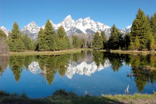
Day 67 Monday, May 7, 2007 Early Morning
Victor, ID to Grand Tetons, Wy – 45 Miles
This morning I took off from our campground at 5am to catch the sunrise on the Grand Tetons. I drove the 45 miles over the Teton Pass and through Jackson, Wy into the park and found the great spot mentioned in the Photographer’s Guide to Yellowstone & the Tetons, a book Helinka Papison loaned to me for this trip. The spot was off of Antelope Flats road down Mormon Row; there are several abandoned old barns there that make for good material when taking photos of the Teton Cathedral Group.
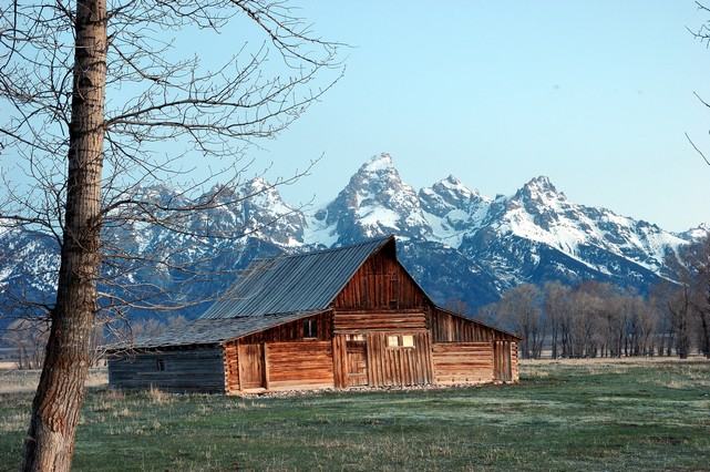
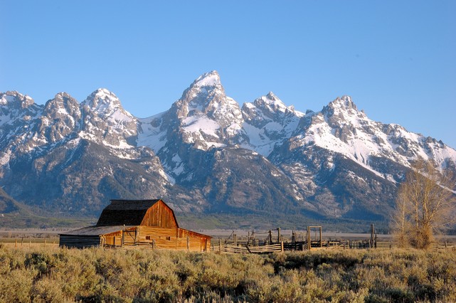
It was very cold out there this morning, high 20s I’m sure! The first photo above was take just before sunrise and the other one shows the sun just illuminating the barn and the Teton Cathedral Group.
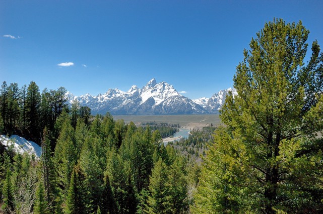
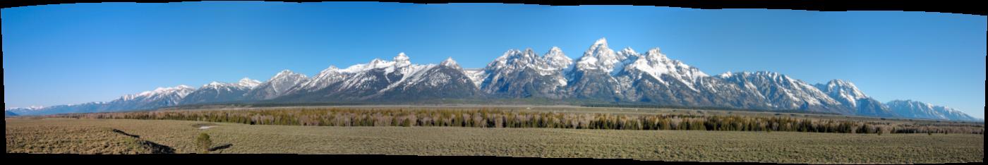
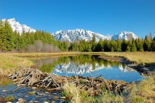
Here is a panoramic photo made for 7 pictures took as I panned from right to left to get a complete picture of the Tetons.
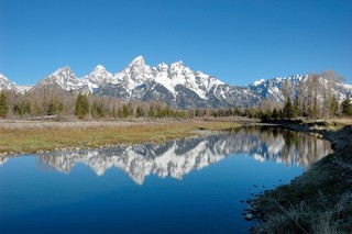
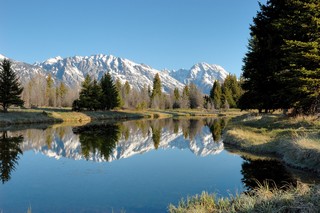
At the barns another photographer told me about another great place for some photos. This was just down the road to a gravel road leading to Schwabacher Landing on the Snake River. I parked the car and walked down an old fisherman’s trail leading north along the banks of a small backwater of the Snake River. As I was walking the path the same photographer from the barns viewpoint showed up and took me along to show me some great viewpoints for photos.
More to follow in my next posting……
Day 66 Monday, May 6, 2007
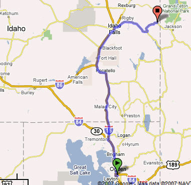
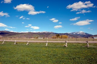
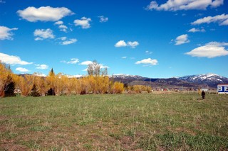
Hill AFB, Utah to Victor, Idaho – 252 Miles
We’ve got ourselves a convoy. At the campground we met Emily and Andy Gleason from New Jersey – they are doing a three month trip as well and they are also on their way back to the East Coast. They had debated going to Yellowstone or not since they had heard there had been some snow up there. After talking with us they decided go ahead and join us to the Grand Tetons and Yellowstone. So, we got the CBs fired up and headed down to highway. The scenery again was breathtaking with rolling hills, meadows with horses and in the background tall snow capped mountains. We entered Idaho, the spuds state, with pleasing hills and fields prepared for the spring as far as the eye can see. The scent of wet overturned soil was in the air. We were definitely in Cowboy country. We made it up some pretty steep hills to our campground which was surrounded by mountains. Just what the doctor ordered. A point worth mentioning – some of the roads have had quite steep inclines and as you can imagine this coach is slower than molasses in January negotiating these steep hills. When ever possible we try to pull over to let the normal faster traffic go by…Idahoians were very appreciative of this jester of consideration; everyone of them honked their horns and waved as they passed by. I, a cynical 95 driver, did not recognize their appreciative honks at first, rather thinking they were upset with us; however, Sylvia set me straight; it’s good to get a different perspective.
Every campground has different amenities. This one provided WiFi, yeah! however, we were so far in the mountains there was no TV reception – no problem! We rely on our emergency radio for our weather forecast anyway.
Having Andy follow us was a good thing as he pointed out to us that our bikes hanging on the back of the RV were hanging too low on the ladder obscuring our right break light on the coach…not good. We took care of this right away moving the bikes up clearing the view of the break light.
Days 62 - 66 Wednesday, May 2 through Sunday, May 6, 2007
Sylvia returned on Wednesday. As I mentioned in the last posting I kept myself busy while she was away by pulling some maintenance on the RV and the Honda. I washed and waxed the RV, Honda and even Lucy with a few naps here and there… The weather was warm during the day chilly at night.
Hill AFB has a great Gym which is located right across the street from the RV park. It appeared to be brand new. I knew Sylvia would love it when she returned and she did; especially since I had set her up for a massage for the afternoon she arrived back to the RV. The prices were just too good to be true, about a third less than in Virginia. We spent a lot of time this week going to the Gym utilizing their great exercise machines and taking advantage of the sauna and steam rooms. Sylvia even found her a Yoga class to go to!
We did drive down to Orem, Utah to visit our good friend from Germany, Gloria Gorden. Gloria was our traveling partner on our trip to Moscow and Leningrad while we were all stationed in Germany. Gloria and Sylvia also worked on a project together to collect clothing in Heidelberg, DCSENG for Rumanians after Romania opened up. Clothing was collected and shipped to Romania via a German Relief Society.
We had a great lunch while we caught up; we had last seen each other when Gloria visited us in VA several years ago. Later on we enjoyed dinner with her family Mike, Martine, and Matt (8) at a great Chinese place. Matt recommended his favorite, Teriyaki Chicken, a good choice Matt!. Martines’ parents joined us as they were in town from Manassas for Matt’s First Communion, talking about a small world to run into someone for Manassas while in Utah!
After we enjoyed a glass of wine – it was time to say goodbye but not before Sylvia and Gloria discussed a get together this summer in TN.
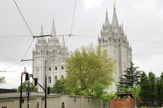
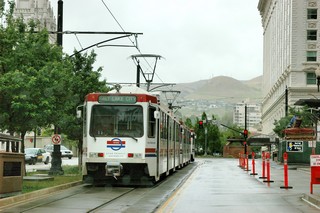
Saturday, we made a trip into Salt Lake City to look around a little. The weather was really cold, raining and downright ugly, so we really only found the best German Deli in Salt Lake and had a great lunch of Weiss Wursts, potato salad and a good German beer.
Later on the way out of town we drove by the Mormon Temple and also noted the they had European-like street cars in Salt Lake.
Day 59 - 61, Sunday, Apr 29 through Tuesday, May 1, 2007
After about 2 months on the road I thought it was a good time to take some time and wash and wax the motorhome while waiting for Sylvia to return so we could continue our adventure. You really do not realize how big this RV is until you start waxing it; this was a full 2 day effort to complete the job especially since I did have to take some breaks for a nap or two.
I took only a few pictures during this work period but I did take a few that I’ll share. This is a panoramic photo of the area looking out from our campsite; not bad, huh?!

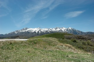
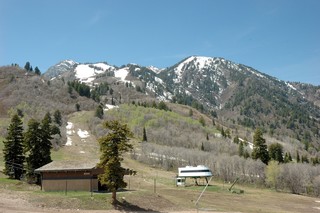
I did take off on Tuesday and took a drive up into the mountains in the photo above. Lucy and I took a hike into the snow and enjoyed the cool and clear mountain air.
On the way I ran across this small waterfall.
Day 56-58 Thursday, April 26, 2007 through Saturday, April 28, 2007
Richard Travels from Travis AFB, California to Hill AFB, Salt Lake City UT– 714 Miles
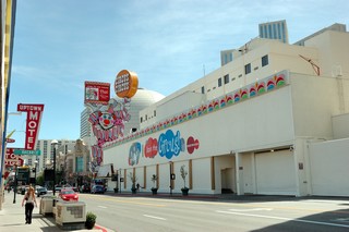
I took off early out of Travis towards Salt Lake City. It was a pretty drive across CA past Truckie, CA by Lake Tahoe and on into Reno, NV. I stopped in Reno and overnighted in the parking lot of the Home Depot there. The manager was very accommodating.
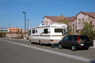
After resting a little I unhooked the car and drove down town Reno to check out the Casino’s and to see how the Reno Strip differed from the one in Vegas.
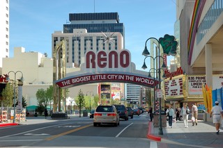
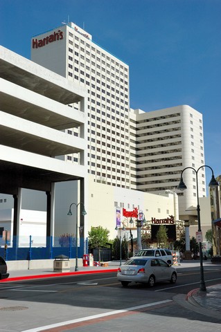
I found the Reno Strip to be far less exciting as the one in Vegas but none the less it was neat to see. Went in and checked out the Circus Circus Casino, played the penny slots and broke even.
Up early and off across Nevada on Interstate 80 towards Utah. After a good long drive I stopped off in Elko, NV and overnighted in the Wal-Mart parking lot along with several other RVs en route to other destinations. Here’s a panoramic photo of some of the country I drove through.
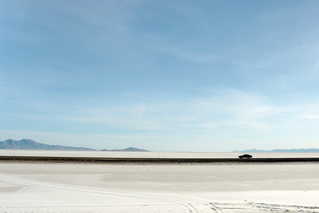
Saturday morning I drove into Utah driving across the salt flats past the Bonneville Speed way. This is really the most desolate and barren part of the country I’ve ever seen. It is flat (but at an altitude of about 4100 feet) and barren as far as the eye can see!!
Here’s a photo that I took out my driver’s window where you can see the other lane going the opposite direction and you can see the utter flat desolation of the white salt flats.
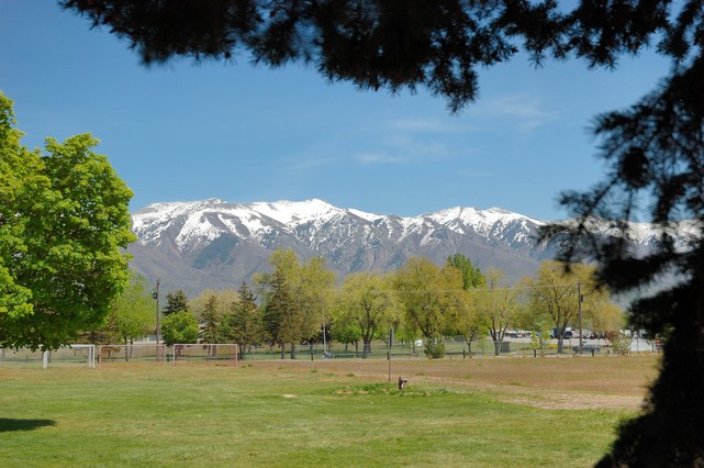
I made it to Hill AFB shortly after noon on Saturday. Here’s a view of the mountains from the campground; what a view!!
Day 55 Wednesday, April 25, 2007
Sylvia Flys Out of Oakland International to Washington
Got up really early this morning to make the hour drive into Oakland to take Sylvia to the airport for her flight back to Washington.
She arrived back in Virginia and said she was amazed at the size of our kitchen and bathroom at home after living in the RV for a couple months. She said she felt like a visitor and her short time at home did not allow her to get too excited about all the things we normally do in the spring to get the yard in shape. Linda and Romano took excellent care of the house and she said it was nice getting together with them to catch up. So with not enough time to worry about what we have to do once we return she just enjoyed visiting with friends and family. It was so good to see John and Christine again. The grandkids, Tanner and Sophia, must have grown at least an inch in the past 7 weeks. She loved getting caught up on all the going ons in their busy lives. The First Communion was very touching and we were so proud of our young man. Afterwards they celebrated at John and Christines’ house with family and friends. Family, friends, laughter and good food are ingredients for a great recipe for good memories of this special occasion.
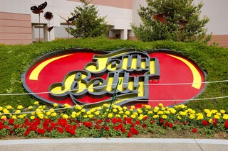
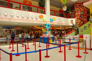
While Sylvia was flying back to DC, I took the opportunity to visit the Jelly Belly Candy factory. It was really interesting taking the tour to see how the Jelly Belly Beans are made and to hear the history of the company.
The were Ronald Reagan’s favorite and official White House candy. This, in fact, is what did it to put this candy company on the map and made their sales sky rocket. Here’s a Jelly Belly Bean mosaic of Ronald Reagan.

Day 53 Monday, April 23, 2007 & Day 54 Tuesday, April 24, 2007
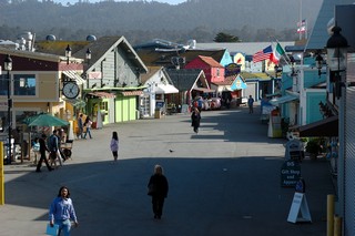
Back to San Francisco
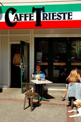
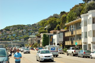
Today we headed back to San Francisco; we decided to try to drive into the city to give us some more options on seeing some outlying areas. On the way in we routed ourselves such that we could go to Sausalito, the town you see across the bay from San Francisco. We walked along the Bay and stopped for coffee at Caffe Trieste, taking in the sun and people watching.
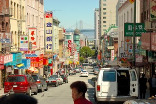
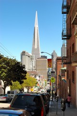
Afterwards we drove over the Golden Gate Bridge into San Francisco. We drove into China Town, parked and found a nice little place for lunch. We walked around China Town and were able to visit a Fortune Cookie factory where we watched them make the cookies and add the fortunes. Fun!!
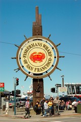
We then visited the Fisherman’s Wharf
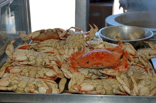
and of course had to purchase some of the famous Sourdough Bread from the Factory. According to the poster they invented the sourdough soup-bowl.
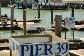
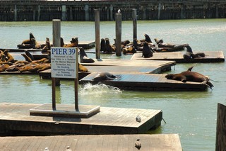
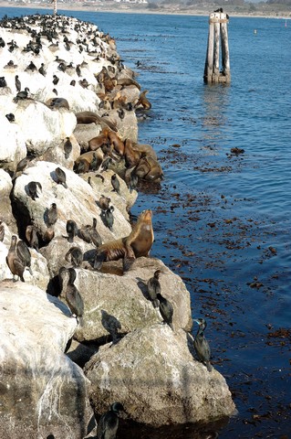
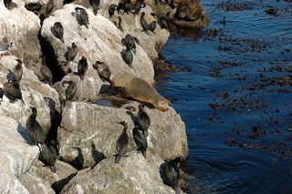
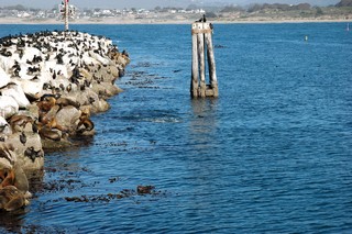
We walked on down to the famous Pier 39 and were entertained by the Sea Lions as they made a lot of barking noise and playfully pushed each other in the water as they seemed to play “king of the hill”.
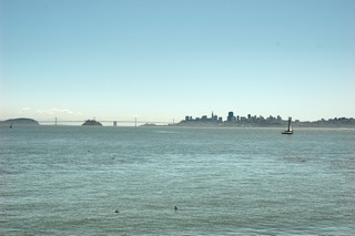
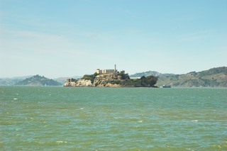
Got some good views of Alcatraz Island from Pier 39.
Tuesday, April 24, 2007 – Rest
Today we took it easy riding our bikes around the base and walking Lucy. With Sylvia leaving tomorrow to fly back to Woodbridge for Tanner’s first communion we took the opportunity to get her packed up for the trip.
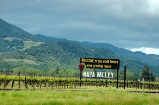
Day 52 Sunday, April 22, 2007
Napa Valley
Today we headed back to Napa Valley so Sylvia could do some serious wine tastings. We visited Hagafen Cellers on the Silverado Trail
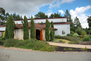
and Clos Du Val with it’s lovely picnic grounds and flower garden, but kind of snooty
and the Hess Collection Winery.
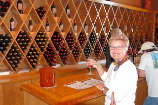
After sampling Sylvia purchased one bottle of wine at each winery, as the RV is packed to gills. However, she took notes in order to purchase some of the other types of wines once we return to VA. Needless to say by the end of the wine tasting she was very “happy”. She decided she must return to Napa again and she thought this would be a perfect place for a “Ladies’ get away”. I wonder if they have a place like Napa Valley for beer and have Micro Brewery tastings????
Day 50 & 51 Friday, April 20, 2007 and Saturday, April 21, 2007
Friday…. a day of rest and maintenance
After the nice day yesterday in Napa Valley we took a day off to take care of some normal daily maintenance activities around “the house”. We also rested up and relaxed by biking around the base and taking Lucy for some long walks.
Saturday – San Francisco
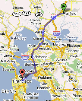
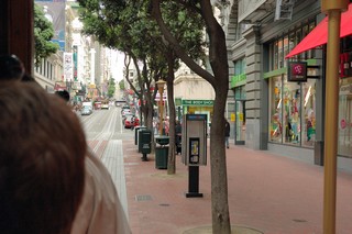
Today was our first day to visit San Francisco. We could have driven; however, we decided to drive to Concord, CA (45 minutes) and take the BART (Bay Area Rapid Transit) metro into the city from there (50 minutes). Saturday was an overcast day with rain threatening in the afternoon; however, we were excited to see the city and the sites.
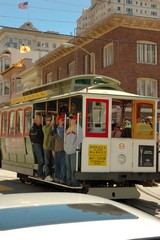
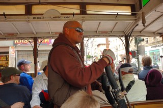
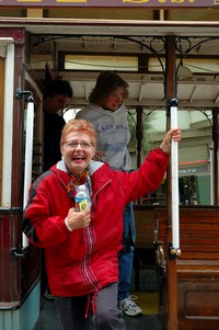
After getting off the BART we surfaced at Powell and Market Streets and purchased an all day passport on the city public transportation system that included the famous San Francisco Trolley. The turn around for the trolley was right there at Market and Powell so we watched as the trolley pulled in and was manually turned around on a “lazy susan” type device!
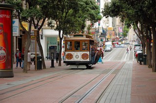
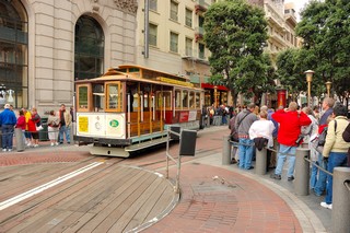
We hopped aboard with Sylvia sitting inside and with Richard standing on the outer step rail and holding on like the guy in the picture above. This was pretty exciting to be hang on with one hand and taking pictures as we rolled down the street with the other hand!
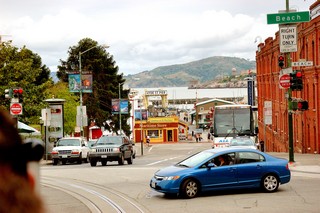
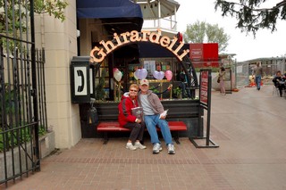
We road the cable car down to the Fisherman’s Wharf area and the walked directly to Ghirardelli Square, built in 1893 as Domingo Ghirardelli’s chocolate factory.
The factory was moved in the 60’s but still has a Ghirardelli cafe and candy store where we immediately ordered some fabulous hot chocolate and purchased some chocolates before leaving.
Now that we warmed up with the hot chocolate, we grabbed a bus and headed for the Golden Gate Bridge. We were determined to get our exercise and walk across the bridge (1 3/4 miles) hoping to catch a bus back across from the other side.
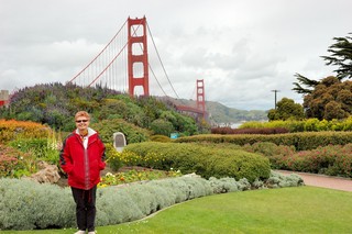
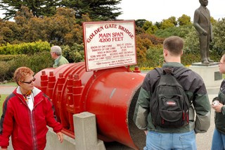
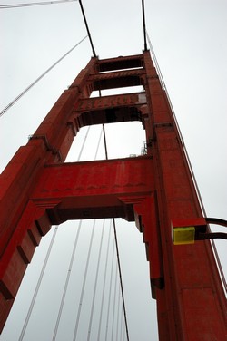
The bridge was quite something to behold! The bridge is named for the deep Golden Gate Strait (400 feet deep) that it spans. It was opened in May of 1937, is 1 3/4 miles long, the towers rise 746 feet; it was designed to withstand strong winds, able to swing up to 27 feet.
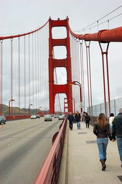
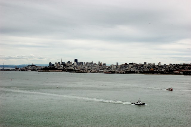
You get a really good view of the San Francisco skyline from the bridge.
Well we made it across the bridge and looked for the bus we hoped to take back but found that there was no such bus and so we hoofed it quickly back across as the sky began to open up with some sprinkling of rain. We were lucky in that it only sprinkled very lightly and so we really did not get wet; however, we were a bit concerned that we would; so, we made it back over the bridge quicker than we did going across the first time!!
We grabbed a quick bite to eat in at Mario’s Bohemian Cigar Store across the street from Washington Square Park in North Beach area. And then made a bee line to the bus to get back to the BART for the trip home.
A very nice day…. and healthy with that long walk across and back on the Golden Gate Bridge. Got to get back for at least one more day to see some more sites of San Francisco…
Day 49 Thursday, April 19, 2007
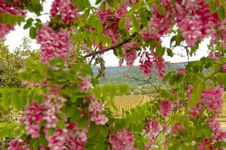
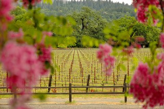
Napa Valley — here we come
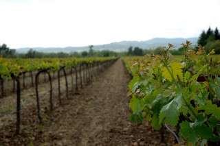
After stopping by the Visitors Center at Napa Valley we headed out for our tour – driving through the valley reminded us of the Mosel River, the Rhein and of course vineyards in Italy. The houses with their red clay roofs just added another touch to this deja vu experience. Many little bed and breakfast along the way invite you to spend the night. Which is not a bad idea. We did learn that now most wineries charge for the tasting to deter college kids stopping in and getting a little wasted before heading to the next wine tasting down the road.
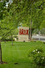
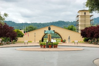
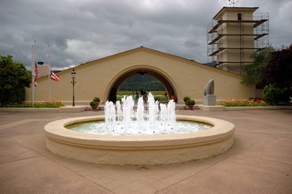
We stopped at Brix for lunch, I had an August Briggs Shiraz with the best burger ever. Sylvia enjoyed a duck sandwich with an a glass of Pinot Noir from the Acacia Winery. We plan on visiting this vineyard!! We drove on up the road and stopped in at the Robert Mondavi Winery where we looked around the beautiful grounds and gift shop.
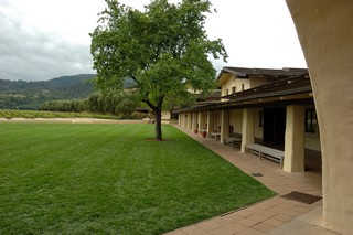
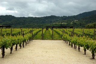
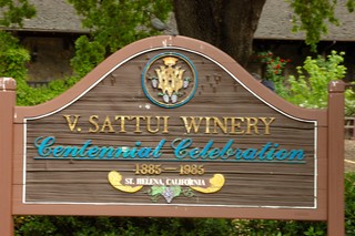
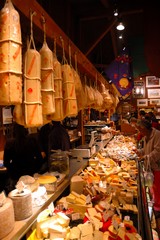
We then drove on to the V. Sattui Winery that was built with stones imported from Europe. There you could enjoy various cheese and Italian lunch meats with crusty bread topped off with a bottle from their winery at picnic tables provided by the winery in their back yard. Since we just eaten we voted for a chocolate cheese cake with a latte instead. Definitely a place we would like to return.
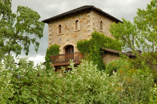
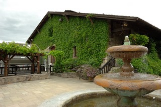
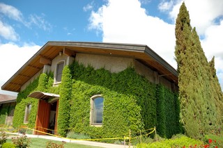
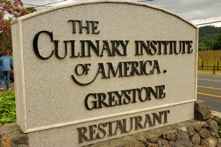
We also stopped by the CIA, yes, you heard right…Culinary Institute of America which is housed at the former Christian Brothers Estate Winery.
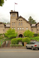
Of course we had to look at all the gadget the cooks use their to whip up their fabulous meals. For a fee you can watch them prepare a dish and then sample it. Again … love to try this one as well.
We are planning on visiting several wineries in the coming days.
Day 48 Wednesday, April 18, 2007
Monterey, CA to Travis AFB, CA (between San Francisco and Sacramento) — 153 Miles
On our way to San Francisco we again initially drove up California Hwy 1 and were amazed at the acres and acres of vegetable fields. We had spoken with a local person yesterday and found that this area along Hwy 1 was considered the vegetable garden of California; rightfully so. The strawberries we purchased were absolutely the sweetest ones for this season. We had already experienced strawberries at the Strawberry Festival in Florida as you my recall in an earlier posting; however, we’d have say the California berries win out over the Florida ones.
We saw many workers in the fields and even the Diamond Organic Farm which Sylvia was familiar with since we have purchased their products in the past. The soil was super dark, not like some of the red soil we are accustomed to in parts of Virginia. We also noticed that artichokes were in season. The plants look like big thistle bushes. We have enjoyed artichoke hearts marinated but never prepared fresh artichokes ourselves – so we just had to purchase some and got on-line for some suggestions on how to prepare them. We decided to steam them and they were excellent; hurrah - for trying something new!
Sylvia has always been interested in recycling; we’ve noticed that recycling in the various campgrounds vary from aggressive to non-existent – which surprised us somewhat. Since we are mainly staying at military bases we thought recycling would be more established throughout these campgrounds. Hurrah for the Commissary at Travis AFB – they charge for bagging in plastic bags. In the San Francisco Bay area there is a big movement underway to save the Bay from the thousands and thousands of bags that wind up in the bay killing the fish and the turtles. A fellow camper involved in the movement informed us that fish and turtles will eat pieces of plastic bags thinking it was food – the pieces of bags then get logged in their throats resulting in a slow death by starvation.
San Francisco area is one of the places we had planned on staying at least a week – which we have really looked forward to. We have gotten into a certain routine, and we can honestly say we always leave a location wanting to stay some extra time – but the road calls and our itinerary to get Sylvia to Oakland fly out of back to Virginia on April 25 is firm. So staying here at Travis AFB for a week sounds like fun. As I mentioned we have had certain routine by now…look at the road ahead for the next destination and the time to reach the destination determines our push off time. The longer the distance the earlier we want to hit the road. We now know 5 to 6 hours is our maximum daily travel time with the RV. One constant we learned… it always takes longer to get there than planned!
Once at the new location we set up and then usually have to head for the Commissary or grocery store as the small refrigerator does not allow us to stock up as we are used to at home.
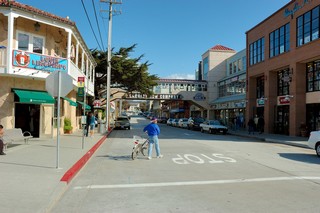
Day 47 Tuesday, April 17, 2007
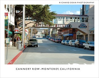
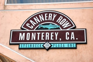
Monterey Cannery Row
Another beautiful day in California…. We took some maintenance time today and later decided to take a bike ride back down to the Monterey Fisherman’s Warf to pick up some fresh fish we had heard about yesterday. We found the fish wholesalers and pick up some fresh red fish and scallops for tonight’s dinner, yummy!
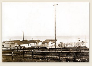
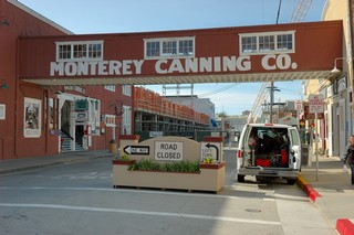
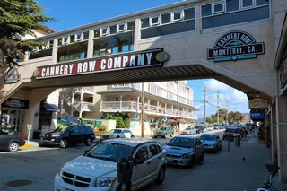
The fish was packed in ice so we decided to do a little exploring further by biking several blocks to Cannery Row. Cannery Row was established around 1902 at the start of the Monterey canning industry by the Booth Cannery in the Monterey harbor and the Japanese canning venture, Monterey Fishing & Canning Co., on the coastline near McAbee Beach.
The “row” expanded during WWI and WWII as sardines were canned to support the troops in Europe.
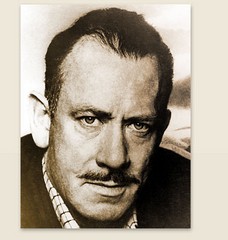
In 1945 John Stienback wrote the book Cannery Row telling of the exploits of a band of bums on Cannery Row, surrounded by bordellos, flophouses, a Chinese grocery store and the laboratory of a man who, in reality, was quietly revolutionizing modern marine biology: Ed Ricketts - the "Doc" of John Steinbeck's Cannery Row. Today, Cannery Row Is a major tourist attraction for Monterey with over 84 retail stores and 20 restaurants.
Day 46 Monday, April 16, 2007
Monterey to Capitola, CA – 39 Miles
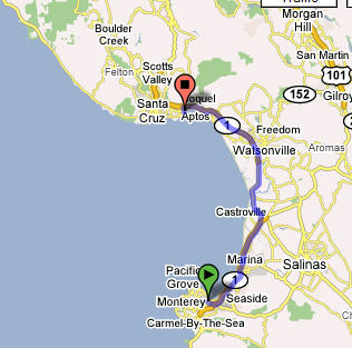
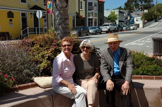
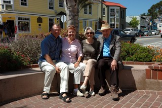
Today we took a drive up the coast on CA-1 to Capitola, CA to meet up with our friends Helga and Jack Perin for a nice lunch at an Italian restaurant on the bay. Helga and Jack are friends from our church back in Woodbridge, VA; they have been out here taking care of Jack’s family business. We had a nice visit and lunch and then we headed back to Monterey.
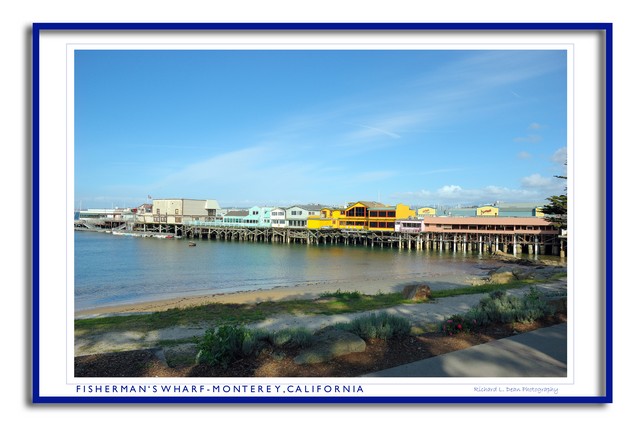
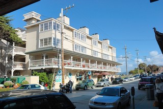
Back in Monterey at the RV we took a little rest letting our bodies rest and catch up with all our adventures of the previous several days. Later in the day we took our bicycles down and road them several miles to Fisherman’s Wharf in Monterey.
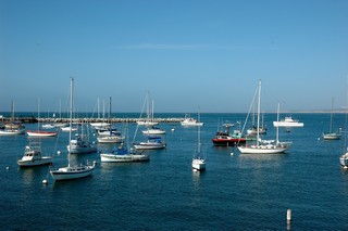
Being later in the afternoon, many of the shops on the “new Wharf” were closed for the day. We asked around about getting some fresh fish and were told to check out the wholesalers on the “old” wharf tomorrow. While on the wharf we heard what sounded like barking or woofing; when we asked we found this was this “happy noise” was coming from the sea lions on the rocks along the Coast Guard pier.

We hopped onto our bikes and peddled over and down the pier to satisfy our curiosity. What a treat to see this site! We have never encountered sea lions in the wild; we’ve only known them from seeing them on TV and in the Aquarium.
Day 45 Sunday, April 15, 2007
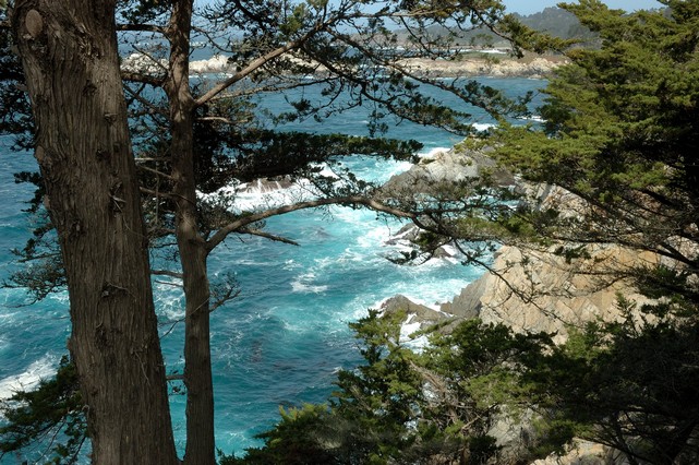
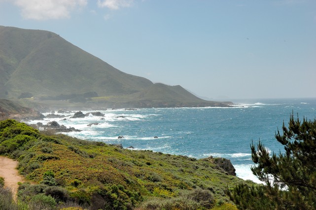
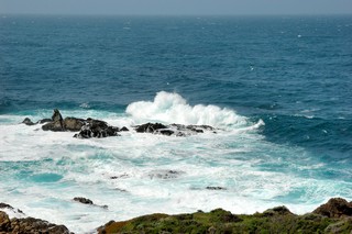
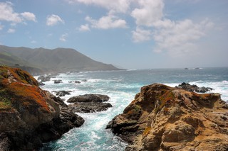
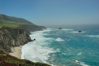
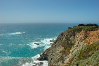
Big Sur
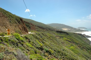
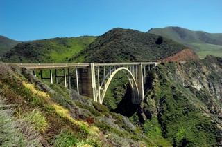
 Today we took a drive down Big Sur from Monterey to the village of Big Sur itself. Big Sur is located along Scenic Highway One approximately 150 miles south of San Francisco and 300 miles north of Los Angeles. Historically, the name Big Sur was derived from that unexplored and unmapped wilderness area which lays along the coast south of Monterey. It was simply called el país grande del sur, the Big South Country. Today, Big Sur refers to that 90-mile stretch of rugged and awesomely beautiful coastline between Carmel to the north and San Simeon (Hearst Castle) to the south. Highway One winds along its length and is flanked on one side by the majestic Santa Lucia Mountains and on the other by the rocky Pacific Coast. This is one road that we would not want to drive the RV on… much to narrow, hilly and winding road! This is a road and scenery to explore slowly by car just as we did today.
Here’s photos of some of the incredible views we saw today as we drove and stopped along the road.
Day 44 Saturday, April 14, 2007
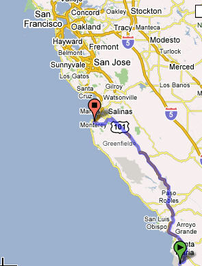
Vandenberg AFB, CA to Monterey – 192 Miles
Today we decided to leave Vandenberg and head on up the coast to Monterey. We had listened to the weather radio and heard that the winds were going to be gusting again on Sunday so we decided to leave today, a day earlier than we had planned so as to avoid the issues with driving a high profile vehicle in high winds!
The weather has turned a little chilly here in California. We are having daytime highs only in the mid-50s the last few days and today was no exception. Today as we drove we had to drive through off and on light rain but by the time we reached Monterey the sun was out but it was still cool outside.
We checked in at the Monterey Pines RV Campground, another nice military RV campground. Since we were 2 days ahead of our current reservation here we had to hope for the best on getting a space without reservations today. They did not have any space in the regular campground; however we were able to “boon-dock” without any hook ups in their overflow area, an old soccer field.
We started up the generator for some power, fixed microwave pizza and had a salad for dinner tonight. The campground and overflow lot are sitting right next to the military Monterey Pines Golf Course and just across from the Monterey County Fair Grounds and tonight there is a live band playing in the fairgrounds amphitheater and we have “front-row” seats for free!!
Tomorrow we are going out to explore the Big Sur coastline going down California Highway 1; we’ll check out the fisherman’s wharf and the Monterey Aquarium and then later in the afternoon we’ll take our bikes and ride the bike trail that runs along the beach.
Days 42 & 43 - Thursday, April 12, 2007 & Friday, April 13, 2007
Carlsbad, CA to Vandenberg AFB, CA – 248 Miles
After getting a recommendation on which route to take through Los Angeles we push off around 9:30 so we would avoid the LA rush hour traffic. We found the traffic to be very familiar to what we were used to driving in the Washington DC area except they have 5–6 lanes each way in many stretches and they have an HOV lane each way right next to the regular lanes (similar to how we have it on Hwy 66 in DC). The HOV lanes require 2 passengers in the car and this restriction runs 24 hours a day.
Go to around Ventura before Richard needed a break; so, we pulled off and filled up with $3.20/gal gas (about $200 to fill up this time!! Ouch!) After a short rest we pushed on toward Vandengerg. The famous California winds were in full force today blowing us all over the road. Richard was having a lot of trouble keeping this high-profile rig in our lane with the 40–50 mph gusts of wind hitting the side of the RV…. really scary today!!
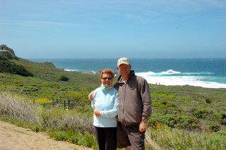
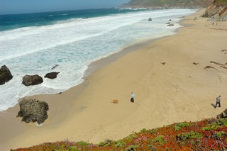
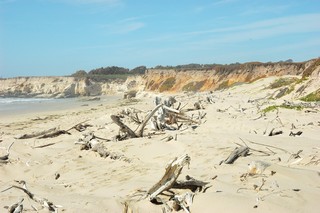
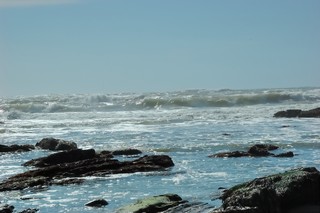
We we happy to arrive safely at Vandenberg and spent Thur and Friday there just relaxing and sitting on their beach. They have 36 miles of beach on this Air Force base but we only saw a short stretch that they allow people to be on.
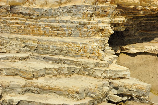
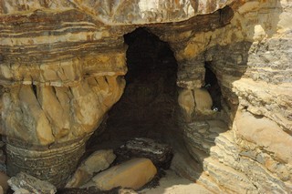
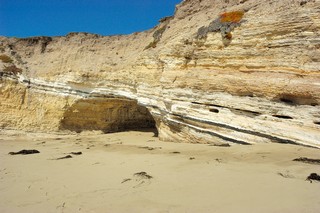
The rock cliffs had some interesting stratifications of different types of soil/rock that showed the history of the earth along this shore line… just wondered what really happened here all those years ago to call these stratifications??
You could see there were interesting caves hewed out of these cliffs as the Pacific waves crashed into the shore at high tide and during storms.
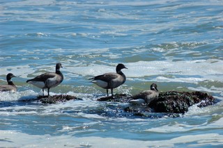
Found a few geese eating seaweed on the rocks. They later were frightened by some other people on the beach and few off.
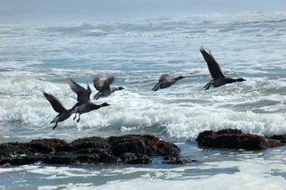
Then here’s a bird that was flying no where… Just let me relax….
Day 40 & 41 - Tuesday, April 10, 2007 & Wednesday, April 11, 2007
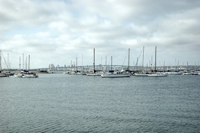
Coronado Island, CA to Carlsbad, CA – 40 Miles
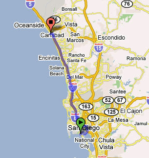
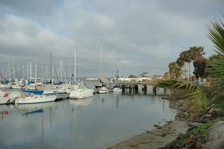
We enjoyed camping at Coronado– watched Navy Helicopters land on Aircraft Carriers -the campground was right on the water with a view of San Diego and this huge bridge crossing the bay from San Diego to Coronado.
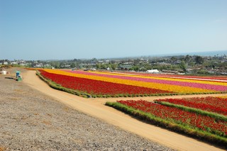
The flowers displays on the highway and in the whole town of Carlsbad were fantastic. Romano and Linda, we found you skinny pine trees– they are all here.
We arrived at Sandy and Len’s and to our amazement there was a Fifth-wheel RV parked in their driveway? Hum, they have been holding out on us; they are RVing as well! Just before we barged in we thought we better give them a call; something did not seem right. Sure enough Einstein, our friendly GPS system took us to their former home, the address Richard put into Einstein,ups! As they say garbage in garbage out holds true with GPS’s as well. We did find them….they were only a few streets away.
John, one thing I forgot to mention – around Yuma, AZ and crossing the mountains into CA we saw many solar panels on roofs. Some were the old type panels as we are accustomed to seeing in the DC area; however, we also noticed a new type of panel that seem to be part of the roof shingles themselves, just slightly darker. This looks promising
As we mentioned Carlsbad is awash in flowers – it reminds us of Germany– Sandy and Lens house was no exception.
Here’s a panoramic photo of the hill side.

Their home was located on a Hill overlooking the Pacific in the distance… we decided to move in… just kidding.
They were gracious hosts and showed us the flower fields and that evening we had dinner at their favorite seafood restaurant. The company, food and wine were excellent. We also did some housekeeping and laundry. Speaking of laundry, it appears when we do laundry we seem to leave a few pieces behind. Sylvia had mentioned to Sandy about the “leaving laundry issue”, Sylvia was looking for her favorite capries in the RV to no avail… don’t know if this is a Freudian slip or not and she something about she means to return here…
We have been experiencing some louder than normal noises with the RV engine lately. We got a name of a reliable place in Oceanside, CA from a fellow camper at the Coronado campground. It had started to sound like a huge lawn mower without a muffler and was noticeably loosing power going up the hills. Turns out that the issue was a leaking exhaust manifold gasket; the same one we replaced back in Woodbridge back in October, Ouch! The shop also said the resonator was coming apart at the seams; seem like we recall hitting a speed bump at Kingsbay too fast and remember the bump hitting the underside of the RV. No choice but to repair it as the plan is to cross the Rockies and Richard will need all the power he can get going up those “small” hills.
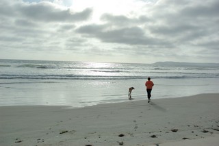
While the RV was being repaired Sandy and Len took us for lunch at their Country Club where Sandy plays tennis. During our visit were able to catch up on the our families and old friends and took several long walks on the beach which was only three miles away.
We sure hated to leave – the Rogersons were such gracious hosts – the scenery and the weather were lovely - but the road was calling!
Day 39 - Monday, April 9, 2007
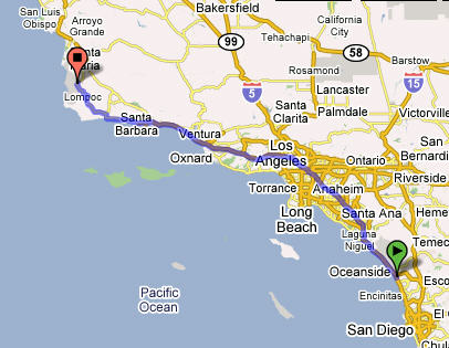
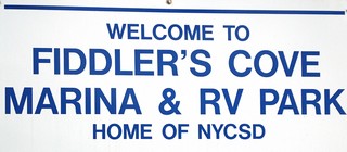
Yuma, AZ to San Diego, CA and Coronado, CA –194 Miles
Onward from Yuma, AZ to Coronado Naval Base Fiddler Cove RV Camp; we left early this morning and arrived here in CA around Noon Pacific time. We’re on our way to Carlsbad, CA to see our friends, the Rogersons, Lynn and Sandy. We stopped over here for the night and tomorrow we’ll push on to Carlsbad.
Day 37 & 38 - Saturday, April 7, 2007 & Sunday, April 8, 2007
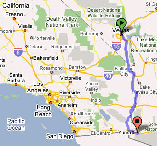
Las Vegas, NV to Yuma, AZ – 294 Miles
We’re off to Yuma Arizona, we’re back in the Dessert and Syliva is going take a chance and try driving the RV….there is really nothing to hit except huge cacti. Wow - it does feel like a big heavy truck.
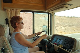
There is not much traffic, but I get neverous about the cars behind me….Richard tells me not to worry about the cars behind me…but to keep an eye on the ones in front of me..Easy for him to say. As we get closer to Yuma I pull over and let him drive. I think he’s a little relieved…. hah!
We were planning on staying at the Yuma Military Campsite, but we were advised to stay closer to town as the Yuma Army Depot was way out in the middle of nowhere. It was let me tell ya!! One of the things Arizona is famous for is all the RV’s here.
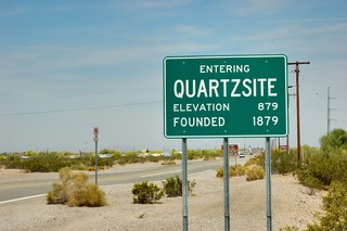
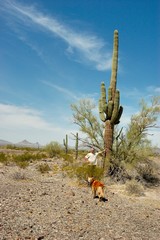
There is actually a town call Quartzsite that is made up of RV’s. Many RV’s come here for the winter from all over the US and Canada. Well we saw it – sure enough – nothing but RV’s!!!!
We joined Passport America to give us additional low cost camping options when Military Camping Facilities are not available. There are many Camping clubs out -they all have pros and cons as we’re leaning from other campers. Once we arrived at our campground we took a dip in their pool had some interesting conversations with some of the remaining “snow birds” who were heading back home up north in a couple days.
We took their advice and visited a local Mexican-American restaurant for dinner only to get there just in time for a “fight” / “shouting match” right there in the restaurant. We figured this was as close as we’d get to the “fight at OK Corral”.
Easter Sunday – Yuma, Arizona and Mexico
We have some special friends who live in Yuma; Pearl Sims Bowman, her daughter Chanoa, and son-in-law Nando. We met up and enjoyed brunch together at I-Hop and then took a quick trip into Mexico since the border is only a few miles away.
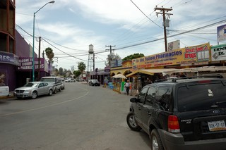
With it being Easter Sunday many of the shops and vendors were closed and home with their families; the place was almost a ghost town. However, you know women on a mission, they’ll always find a place with some bargains. Sylvia was especially looking for some medium size clay vases to complement a Mexican carpet we had purchased in Puerto Vallarta in February. We found some nice ones and so it was time for Richard to do the barginning.
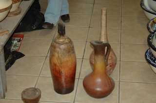
He “hemmed and hawed” and “grunted” a little about how high the initial $95 price was for these three vases. The shop keeper was tough on the deal wanting only to go down to $75 …. We looked in our wallets and only could come up with $58, had to borrow a $10 from Nando. He was the one to make the final offer explaining we had no more money and the shop keeper finally gave in and Sylvia got her 3 vases.
Now we we leaving Mexico with 3 vases and no money to even buy a Margarita before crossing back over the border! Mama mia what we to do? Well Pearl knew this place just before the crossing of the border and thought they would take a check from her local Yuma bank; so we checked and sure enough we were in luck and were able to have some Margaritas in Mexico.
In fact, everyone but Richard, the designated driver, had about 4 each before we “happily” crossed back over into the US. Sylvia insisted they only had two Margaritas each.
Pearl graciously invited us to here condo for some more Margaritas and steaks and shrimp for dinner. We happily accepted. What a great Easter we had with our friends in Yuma! We feel fortunate to have friends living , and we’re able to stop and catch up as we travel accorss the country.
With tomorrow being a work day for Pearl and another travel day for us, we parted wishing we could stay another day; however, we’re off to see new places tomorrow and see some more friends as we drive into California through San Diego and up to Carlsbad to visit Sandy and Len Rogerson. We heard President Bush was to visit Yuma on Monday; couldn’t stay to see him.
Day 36 - Friday, April 6, 2007
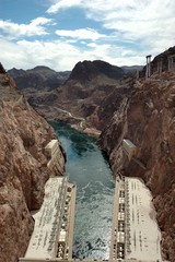
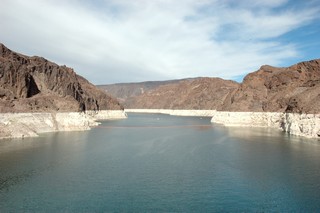
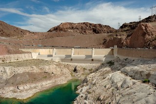
Hoover Dam 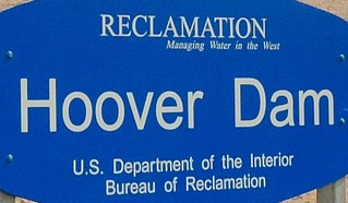
Today was time to do some RV maintenance and get a haircut – we were starting to look like mountain people. We noticed the temperature was going up in the low 90s during the day so we made sure we did all our runing around early morning. I am amazed at the stunts the Air Force Fighter Jets over us seemed to perform; this is the Air Force’s Fighter Warfare School.
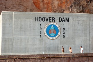
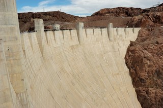
Hoover Dam was noted as one of the world marvels of engineering. Before the construction of the dam, the Colorado River Basin periodically overflowed its banks when snow from the Rocky Mountains melted and drained into the river. These floods endangered downstream farming communities. In addition to essential flood control, a dam would make possible the expansion of irrigated farming in the parched region. It would also provide a dependable supply of water for Los Angeles and other Southern California communities.
One of the major obstacles for the project was determining the equitable allocation of the waters of the Colorado River. Several of the Colorado River Basin states feared that California, with its vast financial resources and great thirst for water, would be the first state to begin beneficial use of the waters of the Colorado River and therefore claim rights to the majority of the water. It was clear that without some sort of an agreement on the distribution of water, the project could not proceed.
During its construction, a black Labrador Retriever named Nig was dubbed the offical mascot of the dam. More of the history of the dam may be found at: http://en.wikipedia.org/wiki/Hoover_Dam………
Although we wanted to visit Las Vegas at night – we were too worn out from our afternoon sightseeing so we grilled some fish with Teresa’s secret spice mix and visited with our neighboors at the campsite. We also accomplished some bookkeeping and, as we figured, gas has been the highest expense of this trip. We firmed up our plans for the California portion of the trip after checking in with our friend Pearl in Yuma, our next stop.
Day 35 - Thursday, April 5, 2007
Las Vegas, NV
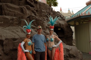
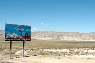
We hit “the strip” early. We drove to the Tropicana, parked and started walking. At the half-priced shows ticket shop we skimmed over the shows available; Elton John and the Red Piano and The Producers shows caught our attention as possibilities. As the day wore on though and our stamina weaned, a show was not what our hearts desired. So we decided to do this another time. The hotels were something – the numbers of people on the street and in the casinos was amazing…is no one working? We did hear on the local news that Las Vegas was the site of a the Formula One race this coming Sunday, Easter Sunday; so a huge amount of folks are in town to see this event.
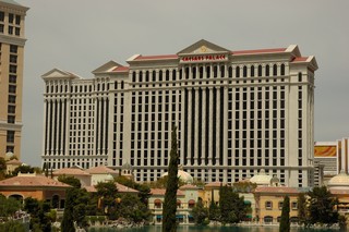
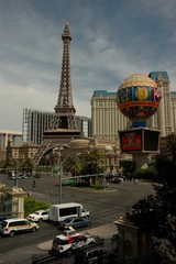
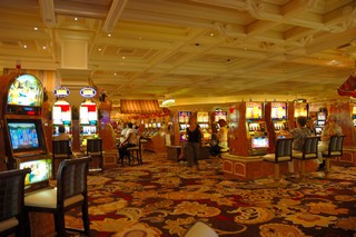
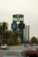
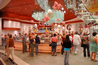
We decided that Las Vegas was the Disney World for grown ups. We stepped into the Bellagio Hotel and Casino – since last year we visited the real city of Bellagio on Lago de Como in Italy. It certainly was impressive. We decided to stay awhile and take our chances in the casino for a while. Sylvia played the slots while I decided to try my hand at Video Poker. Sylvia cleaned up with a total winning of $30.00 and I broke even, so we decided to eat our winnings at the Bellagio Jean Phillippe Patisserie that served scrumptious pastries and freshly made crepes. We strongly subscribe to the idea that the little things make life pleasurable - crepes at the Bellagio was pretty special. Christine -we can highly recommend the chocolate and banana crepes mit sahne.!!!
We returned to the RV in the early evening tired but happy.
Day 34 - Wednesday, April 4, 2007
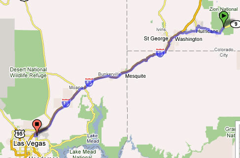
Zion National Park, UT to Nellis AFB, NV (Las Vegas) — 155 Miles
As always we hate leaving the last place behind – however are eargerly looking forward to our next destination, Las Vegas – Nellis AFB. After 4 days of – boondocking in the park without hookups – there is light and lots of water at Las Vegas! We both noted how we dont miss the TV in the wilderness, yet the TV seemed to be turned on a lot while we’re at home. The business of the city feels odd after 4 days of prestine beauty and silence; l guess lights and running water come at a cost.
We’re in the dessert it’s hot!! after the cool evenings and pleasant days we’re hitting 85. Luckily we have AC now. We get settle, restock, (I miss Trader Joes, and Whole Foods), do laundry, even Lucy gets a bath.
Day 33 - Tuesday, April 3, 2007
Day Trip — Zion National Park to Bryce Canyon and Return — 180 Miles RT
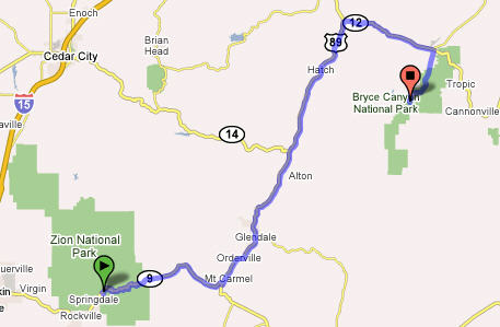
Today we set out to visit Bryce Canyon. We drove through Mount Zion park and actually got to see more of it then what we saw coming in with the RV, which was pretty scary with all the switch backs. Some of the the round smooth rock formation reminded Richard of cow patties. I instead thought they looked like mounds of sahne or meringue….guess what was on my mind?
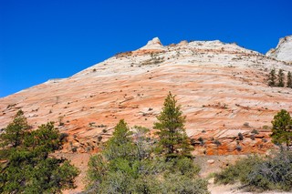
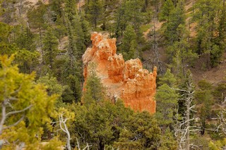
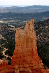
Bryce Canyon is approx 90 from Zion and a definite must see! On the way we drove thought Red Rock and say some more interesting rock formations:
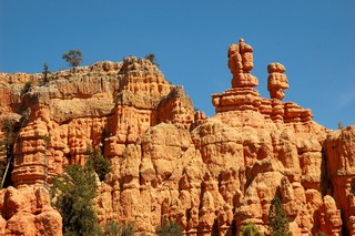
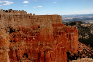
The erosion here form fantastic shapes that are called Hoodoo and Indian word – to cast a spell. They reminded us of Fairy tale castles with many turrids. We did not hike – but looked at the many different vistas. Again the vistas were awesome and as is becoming our Sandra: we wish we had another day here. However, after 4 days our schedule has us leaving for Las Vegas the tomorrow morning. We feel very strongly about bringing the kids out here to see these beautiful parks.
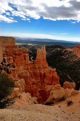
Here’s a panoramic photo (actually 5 photos stitched together) of Bryce Canyon.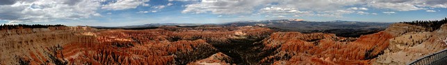
Day 32 - Monday, April 2, 2007
Zion National Park, UT — Day 2
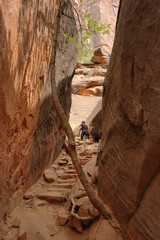
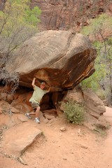
The park has a shuttle service that takes you to each of the significant points; this prevents the major traffic jams that they had in the past and protects the environment. The park shuttle drivers does a great job in explaining the different hikes available along the route– by difficulty level, type of terrain, and what you will see along the hike. So after we picked a hike (Emerald Pools – Upper, Middle and Lower) that we thought was at our difficulty level we set out to conquer the mountain. If you have every been to Maui, you know the road to Hana…well, it was the road to Hana on foot with steep drop offs…boulders in the middle of the path the size of Mini Coopers you had to navigate around …all of this while the path is going straight up. Who picked this hike?…it was supposed to be moderate …of course our egos got bruised even more as kids ran passed us like mountain goats. What are they doing up here anyway? It’s much to steep. Somewhere at about 7000 feet somebody stole all the oxygen.. seemed like we could hardly catch our breath!
Once of the good things about camping you meet some nice folks. Today we met the campers next to us David and Julie with little 18 mo old Jake. They were from northern Utah and they told us they camped as often as they could. They actually hiked with Jake in a piggy back like contraption. Folks in Utah are very healthy!! Later on in the evening while everyone was sitting around the camp fire…David offered us Bear sausage…yup ,you heard right. Bear sausage… Julie informed us that David and his uncles are all hunters…the sausage was actually very tasty…no it did not taste like chicken… more like pork. However, something in that sausage gave me nightmares. All night long I dreamed about a Bear looking for me. No more Bear sausage for me, thank you.
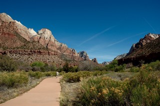
Day 31 - Sunday, April 1, 2007
Zion National Park, UT
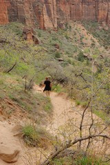
Today was our rest day at Zion. We took a couple short walks with Lucy along the only trail in the park where dogs were allowed.
We found that most all the National Parks are not “pet-friendly”. Guess they do not want the pets chasing the game through the park. Actually the next day when we did walk some of the other hikes we found that there was good reason to not let the pets on these other trails; it would be much too dangerous to allow pets there since they could cause a hiker to take a tumble down some of those steep drop offs on many of these mountain trails and that would not be good!
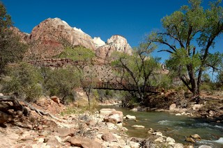
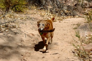
The main river traversing the park is the Virgin River although not deep it was rather fast moving. Lucy going in for a drink got swept away rather quickly and we had to shout at her come several times before she was able to catch hold and pull herself out. Her look of surprise mirrored our look of fear of watching her being swept away.
In this campsite in the park we’re dry camping. We have no hookups here for electric water or sewer although the campground does have drinking water stations were we can get water if we need it. So once it got dark we could only use a few lamps for a limited time that were run off of the RV house batteries. This was ok – since the hiking pretty much wore us out.
Day 30 - Saturday, March 31, 2007
Flagstaff, AZ to Zion National Park, UT — 248 Miles
Today we left Arizona and headed for the Utah border. Our destination today is Zion National Park in Utah. We traveled North out of Flagstaff 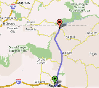
toward Page, AZ. As we got close to Utah we had to cross over the Glen Canyon Dam.
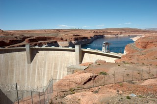
The construction on the dam began in October of 1956. By 1959, the Glen Canyon Bridge was completed permitting the trucks to deliver equipment and materials for the dam and the new town of PAGE, ARIZONA. The crest of the dam is 638 feet above the Colorado River. We stopped at the beginning of the bridge to take this photo and several others. After crossing the bridge and rounding a few curves we came to the Utah border where Sylvia snapped this shot as we passed the welcome sign.
Wow what a journey. The park was built in 1930 – the roads are narrow and in order for the RV to pass through the tunnels they had to close the traffice on the other side which allowed Richard to travel through the middle of the tunnel. I followed with the car – I had to take deep breaths as the tunnel was close to a mile long and so my clostophobia would not get the better of me. I kept saying to myself ..your ok, breath, your ok….
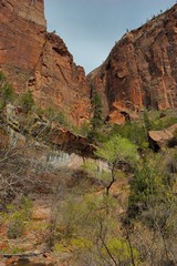
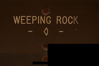
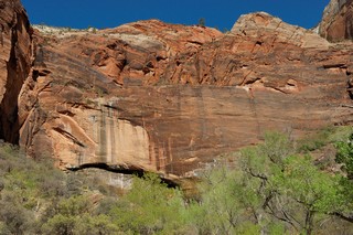
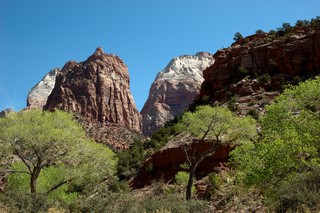
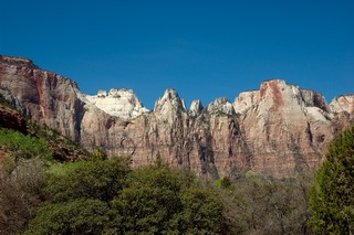
The park is breathtaking – Green canyons, red cliffs, and deep blue skies. The scenery sort of stops you in your tracts. The rocks according to the guide were formed in an environment as varied as sand dunes and shallow sea bottoms. The sand dunes were the tallest in the world millions of years ago and today these sand dunes are now the majestic cliffs and canyons of sand stone. Here are a photo taken from our campsite in the park… What a place to behold!

Day 29 - Friday, March 30, 2007
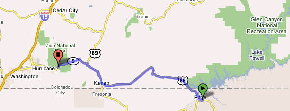
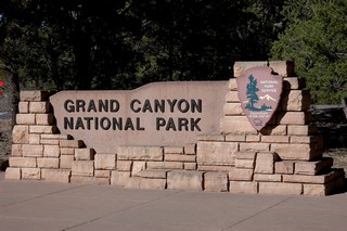
Flagstaff to the Grand Canyon National Park
As the weather service had predicted, we woke this morning to 2 plus inches of snow all over the place. This certainly dispelled our ideas of what we expected from a place like Arizona. We’ve always pictured this place as a hot place… at least a warm place where people go for the winter. Here it is almost spring and we’ve got snow outside. On the plus side, the sky was perfectly clear and a beautiful blue this morning.
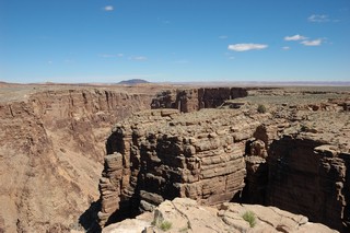
We took our time getting around this morning. Did a little housekeeping things, wrote some cards and planned our day trip to the Grand Canyon. 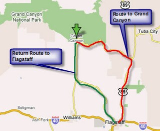 We spoke to some other people in the campground who told us that if they had it to do over they would have taken Hwy 89 north out of Flagstaff and drive the rim road from East to West stopping at the various points along the way. So taking their advice we left Flagstaff around 11:30 a.m. heading up the red route on the map for the Canyon. It was long drive across a lot of barren land to get to the turnoff to the Canyon. After turning off we head up and came to the Little Colorado River Tribal Park run by the Navajo Nation. This was our first stop to look at a most awesome site that we have ever seen.
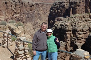
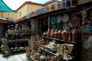
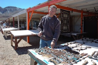
Had to do a little shopping for some of the Navajo crafts. They had such beautiful jewelry and pottery.
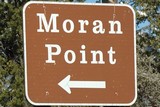
Drove on and stopped at the Desert View and Moran Point just inside the park.
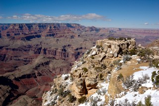
The next point we stopped at was: 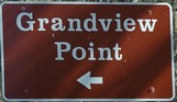 The sites here as before were really fantastic; pictures really do not do this scenery justice.
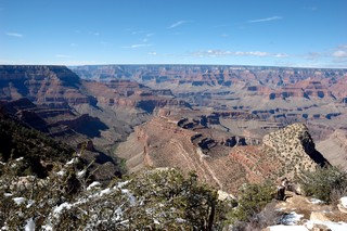
At the south entrance to the park we found they place really crowded with people from all over the world. The crowds were amazing at this time of the year; can’t imagine what it must be like in the summer after school is out.
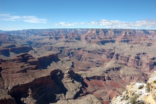
I took a series of 4 photos by panning on a tripod to put them together to get a panoramic shot.
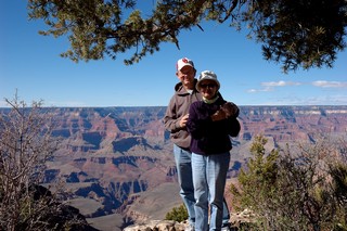
The Grand Canyon… What a wonder of the world… and a must see place!!!!!
On a general note the Crows around here seem to be the size of Chickens, everytime one head my direction my first impulse is to take cover! What are they eating?
We also noted many hitchikers with backbacks of all ages. This is truly a land for the outdoor person. We’ve encountered many families on bikes, and on serious hikes. I’m impressed.
Day 28 - Thursday, March 29, 2007
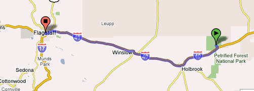
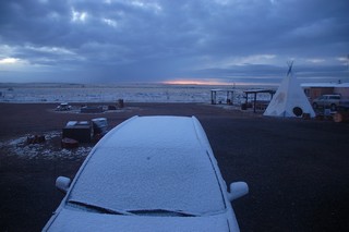
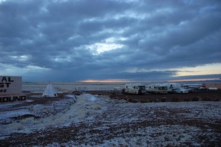
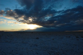
Petrified Forest and Painted Desert to Flagstaff, AZ 118 Miles
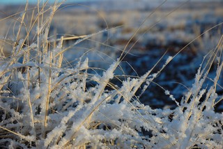
This is what we woke to this morning… “Frost on the Pumpkin”. It had snowed enough to cover the car and dust the ground.
Got up and around to take some early pictures before leaving for Flagstaff.
Pulled into Flagstaff before noon and found a campsite. We stayed in a campsite with full hook ups since the weather forecast was calling for 18 degrees and 2–3 inches of snow before morning! 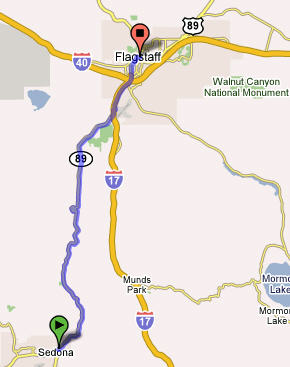 To make the best of the rest of the day we finished setting up the RV and headed out to see Sedona, AZ. Sylvia had been there back in 2001 when she was on TDY to Arizona and wanted me to see this awesome site.
Sedona is located in Arizona's high desert under the towering southwestern rim of the vast Colorado Plateau. The drive was winding down through some beautiful red rock canyons.
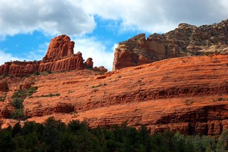
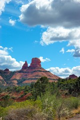
The two following photos were taken in the town of Sedona; you see some of the threatening clouds and weather that was to dump some snow on us tonight.
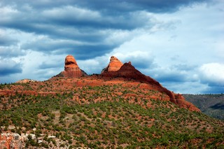
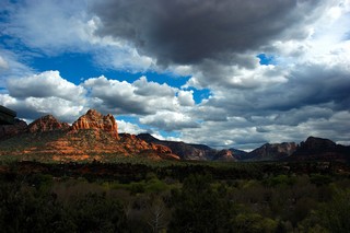
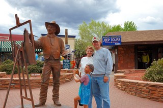
Day 27 - Wednesday, March 28, 2007
Albuquerque to Painted Desert National Park in Arizona — 211 Miles
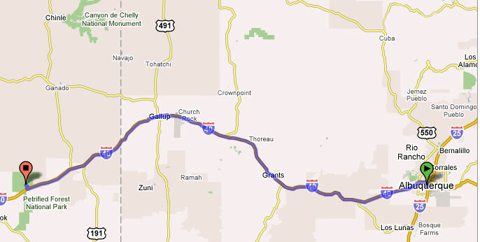
This morning we got up and did some more RV preventive maintenance while Sylvia visited the base gym for here morning exercise and swim. This morning we found it relatively cold (lower 50s with gusting winds) compared to what you would expect of New Mexico this time of the year; it actually felt closer to the mid to high 30s!
We topped off with gasoline here at Kirtland for $2.47/gal before heading off to Arizona where we heard the gas was more expensive. Then around noon we headed out toward Arizona into the extremely gusty winds. I was finding it difficult again keeping this large vehicle going straight down the road. About an hour into our drive we actually ran into a blizzard…. I’m talking about snow folks!! This is certainly not what we expected. The blizzard was really spotty and short in duration as we drove on and out of it and then back into the snow from time to time. 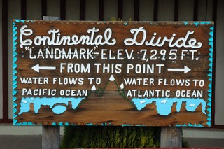
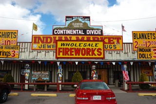
We soon crossed the Continental Divide where we took a short break for me to take a nap and Sylvia to shop in the Indian Trading Post.
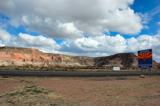 We made it to the Arizona border where we stopped at the Welcome Center and picked up some pamphlets on Arizona. We spoke to the lady behind the desk telling her were headed to the see a lot of sites in Arizona including the Grand Canyon to which she replied that it was supposed to be only 18 degrees there tonight!! Luckily we are not going there tonight but instead we are going to go to the Petrified Forest National Park where we hope to spend the night just outside the park. We were told the park closed at 6pm, so we jumped back on board and headed out to try to make it before closing.
We did arrive at what out watches said was 5:55pm; I quickly ran into the park welcome center to see if we could find a place to camp in the park. I was told we could not stay in the park and had to be out of the park, or at least on our way out, by 6pm. That didn’t give us much time until I found out that Arizona was not on daylight savings time and it was really 4:55pm and we had about an hour to drive through the park. The ranger told us that there was a couple gift shops just outside the south gate that had some places where we could stay the night for free; so off we went into the park to see some of the wonderful sites and get a few pictures for our friends…. you!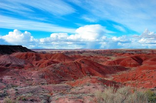
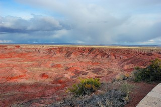 These are some of the beautiful sites and canyons we saw as we drove a little way into the park. If you look closely in the right picture you’ll see little specs of white in some of the crevices… that’s snow folks and let me tell you it was just a bit chilly here at the painted desert and the petrified forest. Just look at that expression of “frostbite” on Sylvia’s face!
 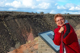 Doesn’t she look cold!
Here are some more photos of the beautiful scenery that we quickly stopped and took for you to see. The pictures really do not do justice to this place. I really needed a very wide angle lens to really give you the perspective of what we actually saw.
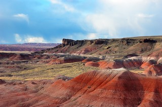
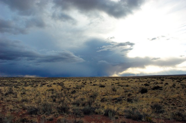
Just look at that storm coming in from the West; this is one with a lot of snow in it… sure hope we get out of its path when we get to where we’ll be spending the night!! 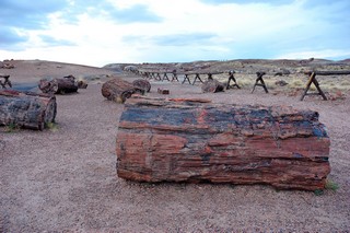
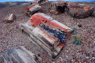 As we drove on through the 24–26 miles of the park we came upon the “crystal forest” area where that was a very lot of petrified trees and their remains. This petrified wood is over 160 MILLION years old (that’s 160 with SIX zeros after it!) and it was buried at the bottom of a sea where it was replaced by Quartz and is now the most colorful wood in the world!
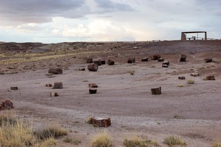
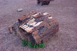
We’ll by this time is was really getting on to 6pm and closing time for the park, so we loaded back onto the RV (Lucy did so reluctantly) and headed on down the park road to find our camping spot for the evening.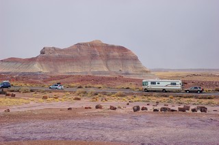
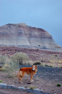
We did find the gift shops just outside the south gate just as the Ranger had said. We found a spot and pulled in where we could hook up to the electricity since we knew that it was going to get much colder tonight and we wanted to be able to use a small electric heater. So here we are tucked in for the night as I finish my writing of this evening’s addition to our blog. Stay tuned for more adventures tomorrow as we decide whether we’ll head on to the Grand Canyon area or to the Canyon de Chelly.
Day 26 - Tuesday, March 27, 2007
Albuquerque, NM — Kirtland AFB FamCamp — Day of Rest
Today was our day of rest after the very long drive yesterday. Did a little maintenance on the RV, took care of some laundry and restocked some of our food with a shopping trip to the base commissary. We also found out that we seemed to be following the famous Rt 66……
Historic Route 66
You may have noted that we have been doing a lot of traveling along Interstate 40. This is the historic Route 66…. Route 66 began in 1925 with an act of Congress. Many existing roads, from Chicago to Los Angeles, were joined to create the new highway. U. S. Route 66 is the highway that wouldn't die. The last stretch of Route 66 was decommissioned by the Federal government in 1985, and the historic road was officially replaced by Interstate 40. Almost twenty years later, Route 66 lives on in books, songs and in the American imagination. Today, "Historic Route 66" signs have sprung up along the route, historic buildings and even their neon signs are being restored and preserved. You can see a short history and a lot of links about this historic highway at: http://gocalifornia.about.com/cs/route66/a/route66.htm
"...and they come into 66 from the tributary side roads, from the wagon tracks and the rutted country roads, 66 is the mother road, the road of flight." -- John Steinbeck in "The Grapes of Wrath".
A little physical exercise….
Did our walk around the parade field with Lucy to get a little exercise and then took a drive to Old Town Albuquerque.
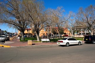
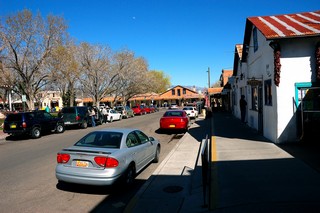
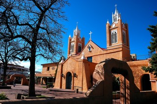
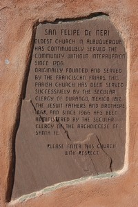
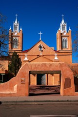
Day 25 - Monday, March 26, 2007
Oklahoma City, Oklahoma to Albuquerque, NM — 546 Miles
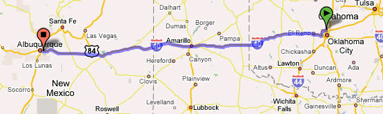
This has been the longest driving day of the trip! We left in the rain and drove into the sunshine. We left Oklahoma City laying at about 1,200 ft in altitude to go up and up as we crossed the Texas panhandle and continued to go up to beyond 7,000 ft as crossed through New Mexico. We drove through Amarillo, Texas and were not impressed by the area. As we drove through the western part of the Texas panhandle and into New Mexico Sylvia noticed many towns with German names (e.g., Stuttgart). Sylvia stated she had never seen such expansive vistas, nothing in the way but prairie grasses and big sky. You had to look hard to be able to tell where the land ended and sky began on the Horizon. This was the first time she saw the plains. With such expansive land she was expecting herds of Buffaloes being chased by Indians… must be too many western movies. Later on we found out that the previous Friday 13 tornados had come through the very area we traveled. Good news… Bad news…. Good news is that we were not there at that time, the bad news is that they did a lot of distruction and people who lived there suffered.
We noticed that we really don’t do well after about 6 hours of driving. The constant moving of the rig and the change in altitude gave us both a headache and we wound up not being a patient with each other as we would normally be.
We have to do a better job in planning the distance we will travel each day in the future.
Day 18 - Monday, March 19, 2007 through Day 24, Sunday, March 25, 2007
Oklahoma
This period of time was very sad for us as we prepared and conducted my mom’s funeral 
and yet we had lighter moments as we had the chance to spend time visiting with our family, many of whom we had not seen for a very long time.
Oklahoma City National Memorial
We visited the Oklahoma City National Memorial and found it to be very moving….
The Oklahoma City National Memorial & Museum was created to honor those who were killed, those who survived and those changed forever by the 1995 bombing of the Alfred P. Murrah Federal Building in Oklahoma City. The Memorial and Museum are dedicated to educating visitors about the impact of violence, informing about events surrounding the bombing, and inspiring hope and healing through lessons learned by those affected. The official website for the memorial is at: http://www.oklahomacitynationalmemorial.org/
This the layout of the memorial grounds. 
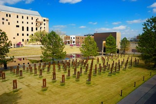 Field of Empty Chairs
168 chairs stand in nine rows, each representing a floor of the building, and represent the 168 lives lost on April 19, 1995. The field is located in what was the footprint of the building.
Gates of Time
Two monumental gates stand as entrances to the Memorial site and frame the moment of destruction between 9:01 a.m. and 9:03 a.m. on April 19, 1995.
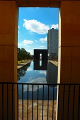
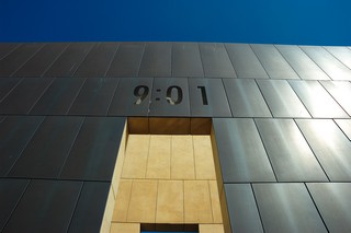
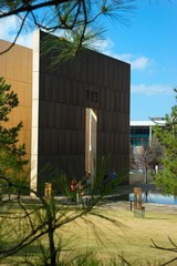
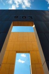
Reflecting Pool
Standing 3/4 of an inch deep, the calming water of this pool stands where 5th Street once stood, and shows the reflection of someone changed forever by their visit to the Memorial.

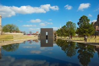
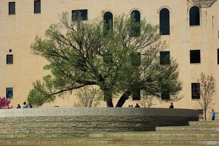 The Survivor Tree
The Survivor Tree, an American Elm, bears witness to the violence of April 19 and now stands as a profound symbol of human resilience. The circular promontory surrounding the tree offers a place for gathering and viewing the memorial.
The Fence
What started as a protective barrier for the destructed site became a symbol of support and hope as people from around the world left notes, stuffed animals, wreaths and other momentos after the bombing. A 200-foot section of the fence now sits on the "healing" Western side of the Outdoor Symbolic Memorial, and visitors still leave items on a daily basis.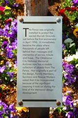
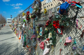
The Memorial Museum takes visitors on a chronological, self-guided tour through the story of April 19, 1995, and the days, weeks, months and years that followed the bombing of Oklahoma City's Alfred P. Murrah Federal Building. 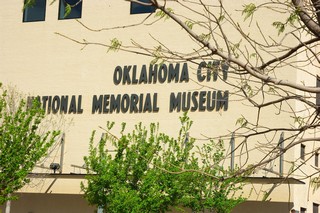
Day 17 - Sunday, March 18, 2007
Robert S. Kerr Reservoir Oklahoma to Oklahoma City, Oklahoma — 183 Miles
We again were slow to rise on Sunday but we finally got our things together and headed out of the state park and on to Oklahoma City. We seem to be leaving things behind … this time we could not find Lucy’s leash. After a final check of the campsite Sylvia found it under the pile of firewood. Again, other than the strong Oklahoma winds, this leg of the trip was uneventful, thank goodness!
As you can imagine we spend many hours these past months planning out this trip. We were planning on visiting Oklahoma and our family. We now were here to do this but also to take my mom into her final resting place in the Purcell, Oklahoma Hillside Cemetery.
Day 16 - Saturday, March 17, 2007
Memphis, TN to Robert S. Kerr Reservoir, Oklahoma — 322 Miles
We left Memphis, TN later in the morning on Saturday. The long and quick trip was starting to take its toll on our bodies; however, we pushed on and did another long day of driving across Arkansas into Oklahoma. The rain was gone but replaced by very strong head and cross winds ranging from 20–30 mph. These winds were very changing when you are driving a non-aerodynamic bus-like vehicle. The winds blew me all over the road as I tried to maintain control. I would note at times that cars coming up behind me would lag back for some time before they would take the risk and quickly pass me. This leg was uneventful except for the winds. We looked at our camping books as we approached Oklahoma to try to find a good place to make a camp for the night.
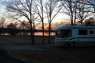 We found a beautiful site at the Oklahoma State Park at the Robert S. Kerr Reservoir close to Salisaw, Oklahoma. We got there just before sunset and found the park almost deserted; only 3 other campers in the whole place.
I built a great big campfire after gathering a lot of wood. Sylvia and had a wonderful evening sitting around the fire warming ourselves in very cool Oklahoma evening. The quiet peaceful evening was disturbed by some howling in the far distance. We called Lucy’s attention to it…I thought it may of been coyotes. After listening to the sound for a while, Lucy headed straight for the coach…She said she was a suburban dog. She did not want to have anything to do with these animals…. Sylvia soon was falling asleep in her chair and finally retired to the coach for the night the rocky journey had taken it’s toll on her. I sat around the fire a bit longer mesmerized by the warm flames as I thought about our journey thus far. I soon followed Sylvia to the coach for the night after putting out the fire with a lot of water.
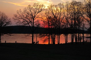
Day 15 - Friday, March 16, 2007
Birmingham, AL
We woke early in the parking lot of Wal-Mart and began preparations to leave. We had parked in a very open section of the parking lot; however, that morning a tour bus pulled in as we were preparing to leave and immediately a bunch of cars began to come out of nowhere and parked all around to get on board the bus. The problem was that they were parking in the rows just in front of the coach and they were quickly beginning to box me in such that if I had wait a few more minutes I would not have been able to get out. I quickly completed preparations and got out of there! Guess you get what you pay for! We found a tire shop across the street where I took my now flat spare tire in for examination and repair. The guys in the shop were very friendly and most helpful; they found that I had a nail in the tire and they actually fixed it and did not charge me a penny for the repair!!
We also found an RV repair shop about 20 miles out of our way to have my faulty stabilizer alarm checked out. The shop found the problem was that the hydraulic fluid was low and this was what the alarm was trying to tell me. Once the fluid was topped off it fixed the problem. However, the mechanic had a heck of a time getting getting the fluid in there – so even if I figured it out I would have had to take it to a shop. We were off on our final leg towards Oklahoma City.
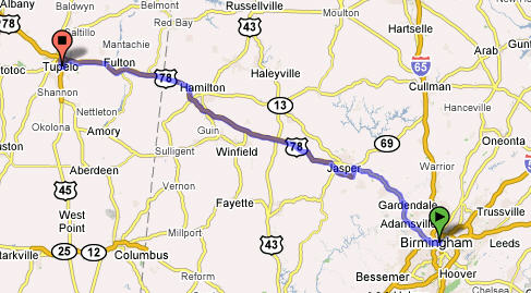 This leg took us through Tupelo, MS and then on to Memphis, TN. We had to stop in Tupelo since this was the birthplace of Elvis Presley. We got fuel, unhooked our Honda CRV and set off to find Elvis birthplace. Tupelo is a very small place and so we had no problem finding it. It was hard to believe that his birth house was actually smaller than our motor home!
There was a museum and chapel at the site along with a few bronze statues and one of his automobiles.
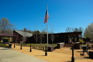
 According to the information provided Elvis left the house when he was 13 years of age, after his Dad packed everything they owned into a 39 Plymouth heading for Memphis. After a short visit, we returned to the RV, hooked up the CRV and were back on the road again. This leg took us to Memphis, TN
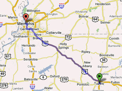
where we spent the night at the Memphis Naval Support Facility.
Day 14 - Thursday, March 15, 2007
Charleston, SC to Birmingham, AL — 461 Miles
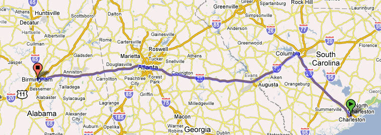
This was our first leg of our trip to Oklahoma City, OK. It was quite a long leg, especially since much of it was driven in the rain. The start was not without incident! We prepared to leave the campsite at the Charleston AFB. The preparation was the same as always — unhook from the water and electricity, move in the living room slide extension, lower the TV antenna, and raise the hydraulic stabilizers. The challenge came when I noted that the alarm light for the hydraulic stabilizers indicated that they were still down! I got out of the coach (of course it was raining),and checked under the coach noted the stabilizers were actually up; however, when I began to drive away the loud audio alarm and visual flashing red light began alerting me to the fact that they were still down and I should not drive. We made the command decision to drive anyway as it was obviously a false alarm . The RV manual did not have anything listed on stabilizers since all individual components come with their own warranty booklets. (That figures). The light and audio alarm went out after I drove a little ways but I was still concerned when the alarms would come on periodically as we drove toward Birmingham! We decided that we would have this checked out in Birmingham before we began our next leg. This stabilizer debacle took 1 1/2 hours from our departure time, which of course was Odark:30.
Little did we know more excitement was in store for us on this travel day. As we drove, we would periodically call my brother Glenn and his wife Cindy on their cell phone since they were traveling the same route through Birmingham and on to their home in San Marcos, Texas. Of course they left much earlier and we expected them to be way ahead of us after our debacle. Outside of Atlanta my brother had trouble with the charging system in his truck and had to replace his battery thinking this would fix the problem. However, around Anniston, AL he called saying he was again having problems and want us to meet up so I could take him to purchase a replacement alternator. We made the connection, replaced the alternator and were off on the road again. We planned to have dinner with them in Birmingham then or ways would part.
Not more than a couple exits down the interstate my brother noticed that my right rear outside dual tire looked a little low. Cindy called us and we pulled off to check it out at the Anniston Army Depot exit.
You guessed it!!! We had a FLAT tire and guess who was not happy!! I was prepared with my FMCA Road Service card and immediately called for help. A couple hours later the road service arrived and changed my tire in the driving rain. Cindy and Glenn stayed with us and helped us pass the time. With the tire changed we were off again finally arriving in Birmingham after dark; we looked for and found the Super Wal-Mart where we spent the night uneventfully, whew!
Day 9 - Saturday, March 10, 2007
Kingsbay Naval Base, GA to Charleston, SC — 208 Miles
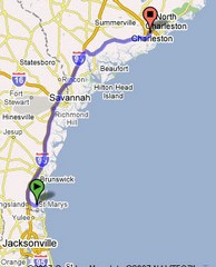 On Saturday we left KingsBay Naval Base, GA and drove to Charleston, SC where we met with my brothers from Alabama and Texas and my sister from Charleston to take care of the affairs of my mom.
While in Charleston we suspended posting of our blog due to the serious and sad task at hand. We spent 5 days in Charleston and left on March 15, 2007 to drive to Oklahoma City.
Day 8 - Friday, March 9, 2007
Kingsbay Naval Submarine Base
It was such a long drive from Tampa, Fl to Kingsbay Naval Submarine Base on Thursday that we decided to spend another day at this very nice campground. The entrance to the base was really interesting as you can see below. This is what we saw…. a submarine appearing to surface through the ground!! Really cool!
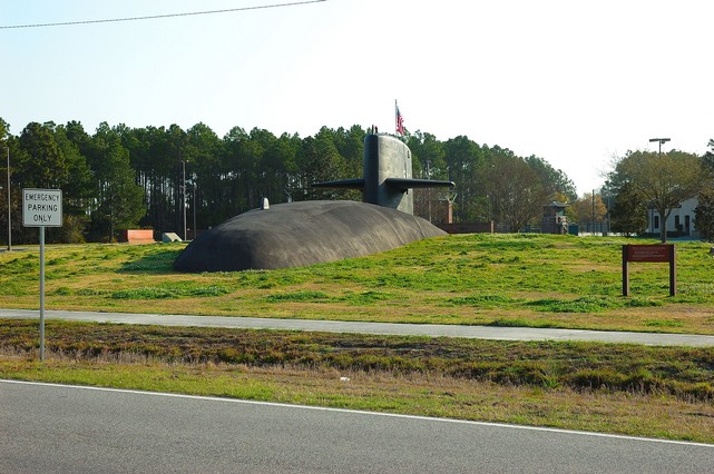
Going to the campground we passed by a display of some of the missiles loaded on some of the submarines.
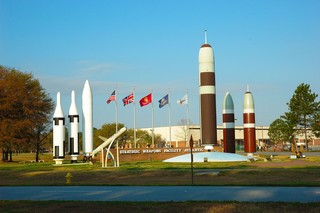
The campground was really new with each site having a concrete pad that was level with full hookups including cable TV. While there the extra day we took the opportunity to take the ferry from St. Mary’s, GA to Cumberland Island National Seashore.
St. Marys, GA to Cumberland Island National Seashore

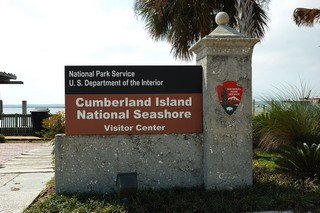
Cumberland Island is Georgia's largest and southernmost barrier island. Pristine maritime forests, undeveloped beaches and wide marshes whisper the stories of both man and nature. Cumberland Island is one of the largest undeveloped barrier islands in the world. The island has one of the largest maritime forests remaining in the United States and one of the largest wilderness areas in a National Seashore on the east coast. With 17-1/2 miles of clean sand beaches and 19,565 acres to explore (the park covers 36,415 acres of which almost half is marsh) the remoteness and visitor restrictions make this a unique place to visit. One of the oldest barrier islands on the Atlantic Coast and with a landmass larger than Manhattan Island, Cumberland Island National Seashore is blessed with rich soil and a number of ecosystems within the confines of its shores. You read a short history of the seashore at: http://www.outdoorplaces.com/Destination/USNP/gacumisl/
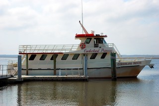 The ferry took about 45–50 minutes. We were escorted by two Dolphins froliken in the wake, much to the passengers delight. Once there we were met by a National Parks Ranger who gave us quick history lesson about the seashore and how it came into the hands of the National Parks Service, a really interesting story.
 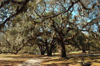 There were huge Live Oak trees all over the island; many were over 300 years old. It’s hard to get a real perspective of how large these trees really are from just looking at this picture; however, trust me they were huge!
In 1880 Thomas Carnegie bought most of Cumberland and built the largest mansion ever to be located on the island. The 59 room Scottish castle completed with turrets, a pool house, 40 outbuildings, golf course, acres of manicured gardens and a squash court must have look incredibly out of place on the Georgia Coast. The mansion was used as a retreat through 1959 when it too burned to the ground. 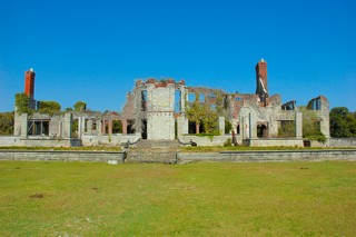
 We walked around a little and tried to get to the other side of the island to see the seashore itself; however, we ran out of time and only got to the sand dunes before we had to turn back to be able to catch the ferry back to St. Marys.
 Lots of sea gulls followed as we ferry’d back to St. Marys.
Day 7 - Thursday, March 8, 2007
Travel Day….. Tampa, FL to Kingsbay Naval Base, GA. 250 miles
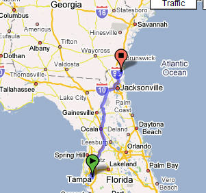
After saying goodby to Alexia yesterday evening we got an early start leaving around 8:30 am. Before we made it off the base Richard remembered we left the Y-splitter for the water hose connection still connected back at the campsite; oh well, we’ll have to pick up another one at the next Camper’s World we come to.
It was pretty uneventful trip until the near end…….
Gas prices in Florida were running around $2.55 per gallon, much higher than we were paying in Virginia when we left. We knew that gas would be around $2.35 per gallon once we got to Georgia. So watching the gas gauge move toward empty as we drove through Jacksonville, we pressed on to try to get the last 20 miles or so to the Georgia border so we could take advantage of the cheaper gas….
Well you guessed it… We really ran out of gas just as we were crossing the bridge over a river that was the Georgia border!! We coasted down the hill off the bridge to just the beginning of the exit ramp to the gas station; pulled over with no power; and put on the emergency flashers. Richard walked up the hill to the gas station and found them extremely helpful. They provided a 5 gallon can of gas and even drove Richard back to the RV insuring that the RV stared up before driving off. We did drive on up to the station and put in another 75+ gallons.
Lesson Learned: Do not drive the RV with the gas gauge below empty just to save a couple dollars in gas!! Total savings after tipping the gas station man: $10.00… lesson learned regarding how far can you travel once the needle is in the red: Priceless.
The Kingsbay Naval Base was only another 6–7 miles from the station. We made it in here around 2:40pm. After getting set up we took Lucy for a walk around the Lake. The air was scented with Pine needles and the absence of noise was deafening. It was a perfect ending to a somewhat exciting day.
Day 6 - Wednesday, March 7, 2007
Strawberry Festival Day….
The Florida Strawberry Festival is held at this time each year in Plant City, FL. It’s a really big deal down here; so big that the map we have had a plot and a label for the festival grounds; the kids get out of school that week and everybody who is anybody is at the festival. They have big entertainers every day; the day we visited Little Richard was playing at 4pm and Kenny Rogers was on at 7pm. We did not stay for either of them since we really were interested in the strawberry shortcake being served….
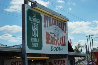
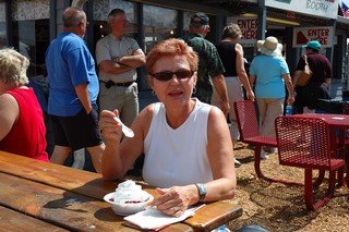
and as you see here we had our share. We also found the displays and exhibits about the growing of strawberries down here in Florida interesting.
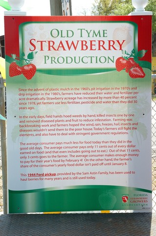
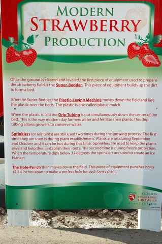
Old Tyme Strawberry Production vs Production Today…. The tractors and equipment were displayed such that you could see the various stages of field preparation…. All done pretty mechanical and automated.
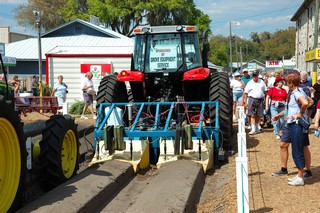 The rows were made using this plow. If you could see the ground in front of this tractor you’d see that it was basically flat. After plowing over the flat ground with this plow you would have “perfect” strawberry rows ready for the next step.
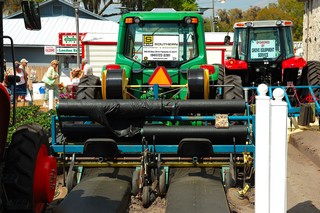 Using this attachment, the rows are covered with “plastic mulch”
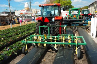 Then using this attachment, perfect holes are punched in the plastic mulch ready for a strawberry plant to be inserted.
The result is the perfect Florida strawberry field. 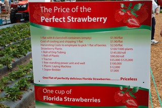
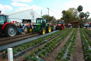 Probably more than you ever wanted to know about strawberries…… We bought half a flat for $6.75; ate some this evening they were great……
Day 5 - Tuesday, March 6, 2007
We went bike riding on the base today. The base is really flat and made for a good place to ride our bikes. We did an easy 6–7 miles.
Spent some time doing a little maintenance on the RV. The heater is acting up and not lighting, so we end up getting a little cool in the early morning hours without the heat working as it should. You would not have thought you need heat down here in Florida; however, it’s been getting really a bit chilly at night here (low 50s to high 40s). I do not think I was able to do anything to get it fixed, so we’ll take it in to the shop when we get to Charleston, SC.
Went to New Port Richie tonight to visit with our daughter, Alexia, and to see her new apartment. She has a real nice place. We went out to dinner and did some more catching up on things.
Tomorrow we’re going to go to the Florida Strawberry Festival over in Plant City. The link to their site is: http://www.flstrawberryfestival.com/default.htm

The festival runs:  Lots of famous entertainers daily (e.g., Randy Travis tomorrow evening).
I’ll be taking some pictures tomorrow at the Festival and will post some of them tomorrow night.
Day 4 - Monday, March 5, 2007
45 degrees in Florida last night…!! Thought it was supposed to be warm down here!
No sleeping in for the weary when you’re camping on a Military Post. At 0700 we were reminded of military life as they played reveille over loudspeaker even making our dog Lucy jump. I had gotten up just a bit earlier as our heater was not kicking on and it was definitely cold in the RV. I had no idea how to fix it except to just turn it on and off a few times. That worked!! We do worry a little about this fickle heater as we are heading toward the parks in mountain country later on during our journey.
We took Lucy for a walk right away this morning to begin getting some exercise daily. Before this trip I was not able to fit exercise into my schedule in Washington.
No real schedule today… just a little relaxation and enjoyment of the sunshine as it warms up. There is a Strawberry Festival going on down here this week, so, we’ll have to make a day trip over and check out some strawberry shortcake – after a bike ride through the base to get some exercise.
We have to work out a schedule for Lucy and I; Sylvia was attempting some Yoga moves this morning in the RV and at this point Lucy decided it must be play time and proceeded to lick her face…
More later….
Day 3 - Sunday, March 4, 2007
Well be did make it to Tampa OK yesterday evening.
Last night we were going to spend our first night at a Walmart, however, we were not very close to one so we decided to spend the night at Truck Stop. We were so tired we just fell asleep. Sylvia was a little apprehensive but we were so tired we just went to sleep. Next morning we were off before 6am amid running Diesel. So much for our first adventure in roughing it.
We had hoped to arrive before 3pm; however, we ran into a lot of rain and a whole lot more traffic and accidents in the Orlando area. We got here some time after 7pm. The campground office was closed but they left directions to contact the night campground host for signing in. We did and were given our site assignment. Got set up, freshened up and drove over to Palm Harbor to have dinner at Crabby Bills with our daughter we have not seen for a while. It was great to see her and we did a quick catch up but said our goodbyes early as all were tired, Alexia from working and us from driving.
Got up this morning early and took a nice walk on the beach with our dog Lucy. Found out later that was a no no. No dogs on the beach! Spent most of the day getting better organized with all the things we brought in the RV. It’s amazing all the things you bring that you think you just have to have and then all the things that you forgot to bring that you really need. We all know the know that feeling you forgot something, but you just don’t know what it is… Took us driving trough five states to figure out we forgot to bring our Turbo Tax…must of been on purpose as a quick calculation previously determined we owed the tax man…Oh well…
Here’s a picture of our Bounder at the campsite in McDill . FL.
Brought Alexia on the base so she could see our “Camper”. She thought the RV was really nice; it had all the essentials and she could see us roughing it. We had a simple pasta dish that our friends Linda and Romano shared with us. We all laughed at the challenge of fixing a meal in a small space, but we managed. We had a nice dinner, visit and walk around the camp ground. Now, we’re gearing down for the night and I’m taking a little to time for this post. My plan is to try to post a little something each day so you all can see what we are up to each day..
Take care friends….
We're off - Day 1 and 2 - March 2&3, 2007
We were all saddened by the unexpected news that my Mom passed away suddenly. I flew to S.C. to be with my sister to assist her with the arrangements. It was my mom’s wish to be buried in Purcell, Oklahoma. The family will meet there on Mar 20 for a the memorial services and funeral. The trip to Oklahoma will be an especially sad one for us as we had planned a family reunion with my mom, my sister and various aunts and cousins on or around Mar 25 in Oklahoma. How does one accept the loss of a parent?
I certainly appreciated all the emails, calls and cards of sympathy and condolences I got from so many people. Please keep us in your prayers and thoughts as we continue to move forward …..
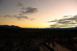
Well the day is finally here and we’re off on our life long journey.
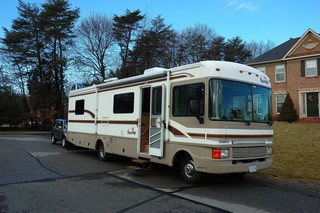
On Friday morning we hooked up and we’re almost ready to roll.
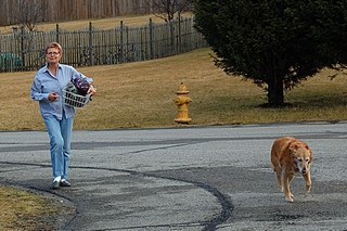
Had to go back to the house one more time to get our bicycle helmets that some places require when we ride our bikes…..
So today, we’re heading out first to Tampa, FL to visit with our daughter. We’ll be staying at the RV Park on McDill AFB where we hope to be right on or park very close to the water. We really love the beach and are looking forward to several days where we can kick back and enjoy the warm climate of Tampa.
Tonight we’ll be looking for a Walmart for our first overnight stay close to 95 somewhere half way to Tampa. Walmarts are supposed to be RV friendly and will let you stay in their parking lots overnight if you check in with them. We’ll see how this works tonight….
More later…. as we journey and stop along the way.
Richard and Sylvia's RV Photo Travel Blog
This is our photo travel blog to journal the travels and adventures of Richard and Sylvia Dean and our dog Lucy as we begin our life long dream to travel across these great United States to see our country and it’s magnificant wonders. Our dream has always been to do this as soon as we could practically do so and earlier than later in life so we could enjoy our journeys. Some significant events in our lives recently have given us the incentive to begin this journey now. Our goal is to document this journey and record our travels photographically in this Blog so that our friends and family can know what we are up to and can live our dream with us vicariously as we travel and photograph our great nation.
We hope you will enjoy the journey as much as we will……
Thanks for following along and providing us feedback and your comments on our journey and our photography…….
Best Wishes to all of you as we set out . . . . . .
