Day 29 - Friday, March 30, 2007
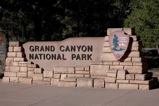
Flagstaff to the Grand Canyon National Park
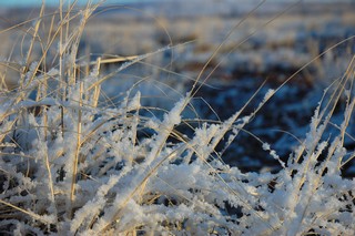
As the weather service had predicted, we woke this morning to 2 plus inches of snow all over the place. This certainly dispelled our ideas of what we expected from a place like Arizona. We’ve always pictured this place as a hot place… at least a warm place where people go for the winter. Here it is almost spring and we’ve got snow outside. On the plus side, the sky was perfectly clear and a beautiful blue this morning.
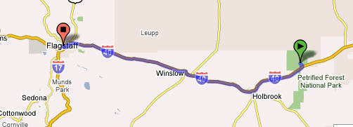
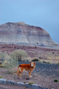
We took our time getting around this morning. Did a little housekeeping things, wrote some cards and planned our day trip to the Grand Canyon. 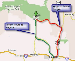 We spoke to some other people in the campground who told us that if they had it to do over they would have taken Hwy 89 north out of Flagstaff and drive the rim road from East to West stopping at the various points along the way. So taking their advice we left Flagstaff around 11:30 a.m. heading up the red route on the map for the Canyon. It was long drive across a lot of barren land to get to the turnoff to the Canyon. After turning off we head up and came to the Little Colorado River Tribal Park run by the Navajo Nation. This was our first stop to look at a most awesome site that we have ever seen.
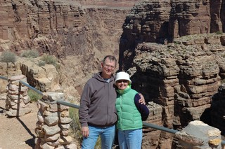
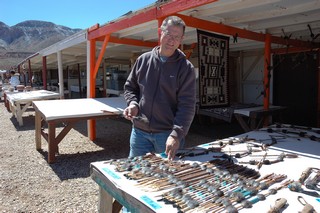
Had to do a little shopping for some of the Navajo crafts. They had such beautiful jewelry and pottery.
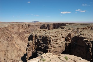
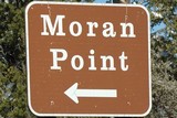
Drove on and stopped at the Desert View and Moran Point just inside the park.
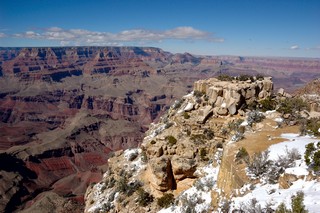
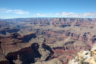
The next point we stopped at was: 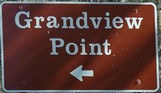 The sites here as before were really fantastic; pictures really do not do this scenery justice.
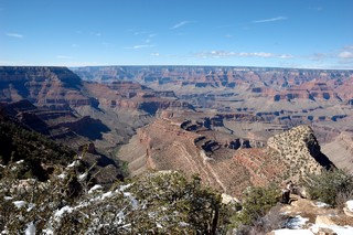
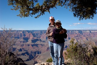
At the south entrance to the park we found they place really crowded with people from all over the world. The crowds were amazing at this time of the year; can’t imagine what it must be like in the summer after school is out.
I took a series of 4 photos by panning on a tripod to put them together to get a panoramic shot.

The Grand Canyon… What a wonder of the world… and a must see place!!!!!
On a general note the Crows around here seem to be the size of Chickens, everytime one head my direction my first impulse is to take cover! What are they eating?
We also noted many hitchikers with backbacks of all ages. This is truly a land for the outdoor person. We’ve encountered many families on bikes, and on serious hikes. I’m impressed.
Day 28 - Thursday, March 29, 2007
Petrified Forest and Painted Desert to Flagstaff, AZ 118 Miles
This is what we woke to this morning… “Frost on the Pumpkin”. It had snowed enough to cover the car and dust the ground.
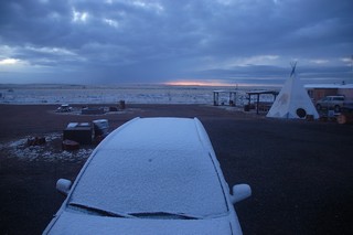
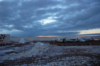
Got up and around to take some early pictures before leaving for Flagstaff.
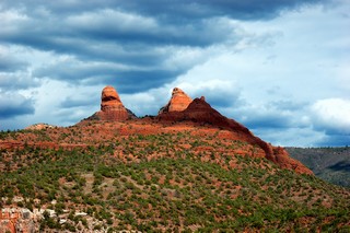
Pulled into Flagstaff before noon and found a campsite. We stayed in a campsite with full hook ups since the weather forecast was calling for 18 degrees and 2–3 inches of snow before morning! 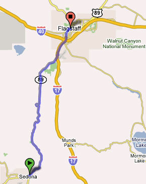 To make the best of the rest of the day we finished setting up the RV and headed out to see Sedona, AZ. Sylvia had been there back in 2001 when she was on TDY to Arizona and wanted me to see this awesome site.
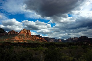
Sedona is located in Arizona's high desert under the towering southwestern rim of the vast Colorado Plateau. The drive was winding down through some beautiful red rock canyons.
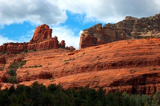
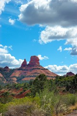
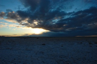
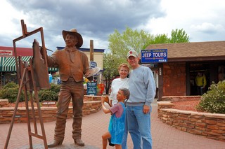
The two following photos were taken in the town of Sedona; you see some of the threatening clouds and weather that was to dump some snow on us tonight.
Day 27 - Wednesday, March 28, 2007
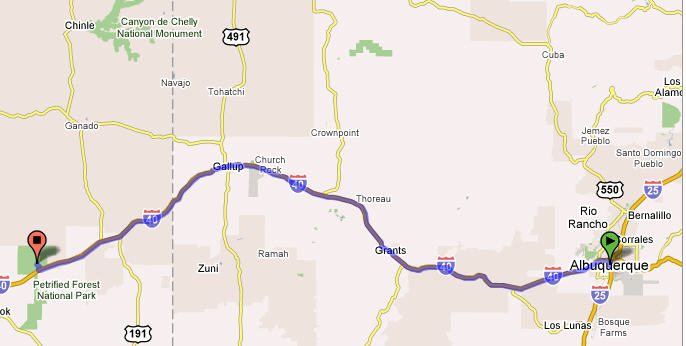
Albuquerque to Painted Desert National Park in Arizona — 211 Miles
This morning we got up and did some more RV preventive maintenance while Sylvia visited the base gym for here morning exercise and swim. This morning we found it relatively cold (lower 50s with gusting winds) compared to what you would expect of New Mexico this time of the year; it actually felt closer to the mid to high 30s!
We topped off with gasoline here at Kirtland for $2.47/gal before heading off to Arizona where we heard the gas was more expensive. Then around noon we headed out toward Arizona into the extremely gusty winds. I was finding it difficult again keeping this large vehicle going straight down the road. About an hour into our drive we actually ran into a blizzard…. I’m talking about snow folks!! This is certainly not what we expected. The blizzard was really spotty and short in duration as we drove on and out of it and then back into the snow from time to time. 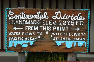
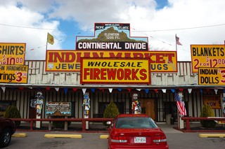
We soon crossed the Continental Divide where we took a short break for me to take a nap and Sylvia to shop in the Indian Trading Post.
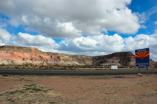 We made it to the Arizona border where we stopped at the Welcome Center and picked up some pamphlets on Arizona. We spoke to the lady behind the desk telling her were headed to the see a lot of sites in Arizona including the Grand Canyon to which she replied that it was supposed to be only 18 degrees there tonight!! Luckily we are not going there tonight but instead we are going to go to the Petrified Forest National Park where we hope to spend the night just outside the park. We were told the park closed at 6pm, so we jumped back on board and headed out to try to make it before closing.
We did arrive at what out watches said was 5:55pm; I quickly ran into the park welcome center to see if we could find a place to camp in the park. I was told we could not stay in the park and had to be out of the park, or at least on our way out, by 6pm. That didn’t give us much time until I found out that Arizona was not on daylight savings time and it was really 4:55pm and we had about an hour to drive through the park. The ranger told us that there was a couple gift shops just outside the south gate that had some places where we could stay the night for free; so off we went into the park to see some of the wonderful sites and get a few pictures for our friends…. you!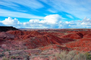
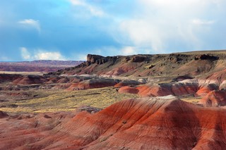
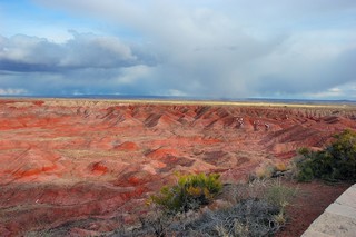 These are some of the beautiful sites and canyons we saw as we drove a little way into the park. If you look closely in the right picture you’ll see little specs of white in some of the crevices… that’s snow folks and let me tell you it was just a bit chilly here at the painted desert and the petrified forest. Just look at that expression of “frostbite” on Sylvia’s face!
 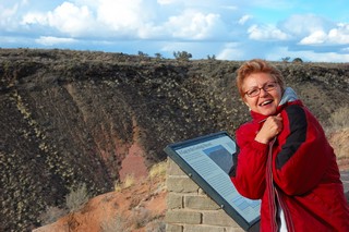 Doesn’t she look cold!
Here are some more photos of the beautiful scenery that we quickly stopped and took for you to see. The pictures really do not do justice to this place. I really needed a very wide angle lens to really give you the perspective of what we actually saw.
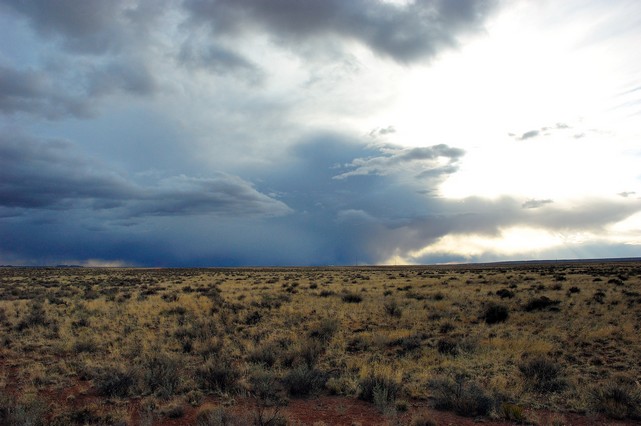
Just look at that storm coming in from the West; this is one with a lot of snow in it… sure hope we get out of its path when we get to where we’ll be spending the night!! 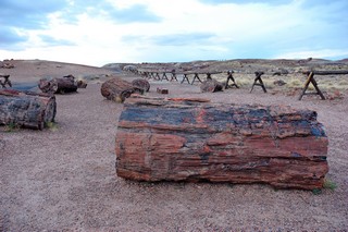
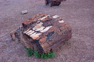
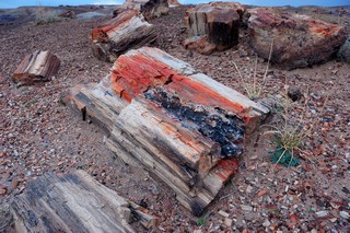 As we drove on through the 24–26 miles of the park we came upon the “crystal forest” area where that was a very lot of petrified trees and their remains. This petrified wood is over 160 MILLION years old (that’s 160 with SIX zeros after it!) and it was buried at the bottom of a sea where it was replaced by Quartz and is now the most colorful wood in the world!
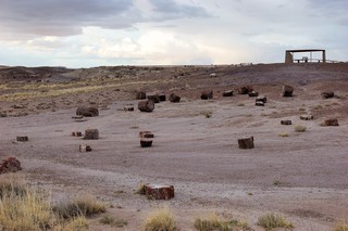
We’ll by this time is was really getting on to 6pm and closing time for the park, so we loaded back onto the RV (Lucy did so reluctantly) and headed on down the park road to find our camping spot for the evening.
We did find the gift shops just outside the south gate just as the Ranger had said. We found a spot and pulled in where we could hook up to the electricity since we knew that it was going to get much colder tonight and we wanted to be able to use a small electric heater. So here we are tucked in for the night as I finish my writing of this evening’s addition to our blog. Stay tuned for more adventures tomorrow as we decide whether we’ll head on to the Grand Canyon area or to the Canyon de Chelly.
Day 26 - Tuesday, March 27, 2007
Albuquerque, NM — Kirtland AFB FamCamp — Day of Rest
Today was our day of rest after the very long drive yesterday. Did a little maintenance on the RV, took care of some laundry and restocked some of our food with a shopping trip to the base commissary. We also found out that we seemed to be following the famous Rt 66……
Historic Route 66
You may have noted that we have been doing a lot of traveling along Interstate 40. This is the historic Route 66…. Route 66 began in 1925 with an act of Congress. Many existing roads, from Chicago to Los Angeles, were joined to create the new highway. U. S. Route 66 is the highway that wouldn't die. The last stretch of Route 66 was decommissioned by the Federal government in 1985, and the historic road was officially replaced by Interstate 40. Almost twenty years later, Route 66 lives on in books, songs and in the American imagination. Today, "Historic Route 66" signs have sprung up along the route, historic buildings and even their neon signs are being restored and preserved. You can see a short history and a lot of links about this historic highway at: http://gocalifornia.about.com/cs/route66/a/route66.htm
"...and they come into 66 from the tributary side roads, from the wagon tracks and the rutted country roads, 66 is the mother road, the road of flight." -- John Steinbeck in "The Grapes of Wrath".
A little physical exercise….
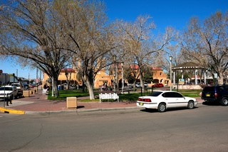
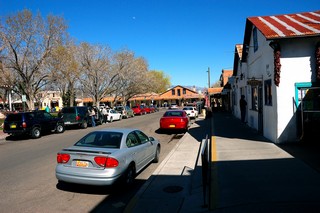
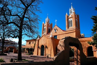
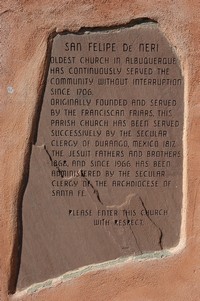
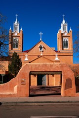
Did our walk around the parade field with Lucy to get a little exercise and then took a drive to Old Town Albuquerque.
Day 25 - Monday, March 26, 2007
Oklahoma City, Oklahoma to Albuquerque, NM — 546 Miles
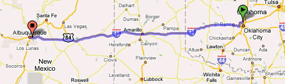
This has been the longest driving day of the trip! We left in the rain and drove into the sunshine. We left Oklahoma City laying at about 1,200 ft in altitude to go up and up as we crossed the Texas panhandle and continued to go up to beyond 7,000 ft as crossed through New Mexico. We drove through Amarillo, Texas and were not impressed by the area. As we drove through the western part of the Texas panhandle and into New Mexico Sylvia noticed many towns with German names (e.g., Stuttgart). Sylvia stated she had never seen such expansive vistas, nothing in the way but prairie grasses and big sky. You had to look hard to be able to tell where the land ended and sky began on the Horizon. This was the first time she saw the plains. With such expansive land she was expecting herds of Buffaloes being chased by Indians… must be too many western movies. Later on we found out that the previous Friday 13 tornados had come through the very area we traveled. Good news… Bad news…. Good news is that we were not there at that time, the bad news is that they did a lot of distruction and people who lived there suffered.
We noticed that we really don’t do well after about 6 hours of driving. The constant moving of the rig and the change in altitude gave us both a headache and we wound up not being a patient with each other as we would normally be.
We have to do a better job in planning the distance we will travel each day in the future.
Day 18 - Monday, March 19, 2007 through Day 24, Sunday, March 25, 2007
Oklahoma
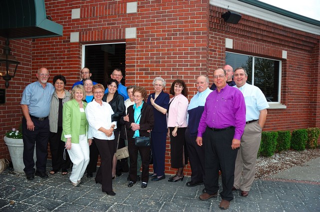
This period of time was very sad for us as we prepared and conducted my mom’s funeral 
and yet we had lighter moments as we had the chance to spend time visiting with our family, many of whom we had not seen for a very long time.
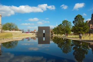
Oklahoma City National Memorial
We visited the Oklahoma City National Memorial and found it to be very moving….
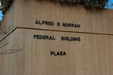
The Oklahoma City National Memorial & Museum was created to honor those who were killed, those who survived and those changed forever by the 1995 bombing of the Alfred P. Murrah Federal Building in Oklahoma City. The Memorial and Museum are dedicated to educating visitors about the impact of violence, informing about events surrounding the bombing, and inspiring hope and healing through lessons learned by those affected. The official website for the memorial is at: http://www.oklahomacitynationalmemorial.org/
This the layout of the memorial grounds. 
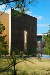
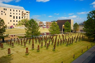 Field of Empty Chairs
168 chairs stand in nine rows, each representing a floor of the building, and represent the 168 lives lost on April 19, 1995. The field is located in what was the footprint of the building.
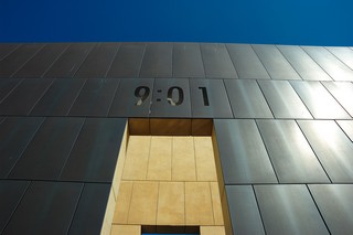
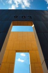
Gates of Time
Two monumental gates stand as entrances to the Memorial site and frame the moment of destruction between 9:01 a.m. and 9:03 a.m. on April 19, 1995.
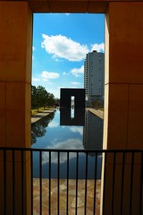
Reflecting Pool
Standing 3/4 of an inch deep, the calming water of this pool stands where 5th Street once stood, and shows the reflection of someone changed forever by their visit to the Memorial.

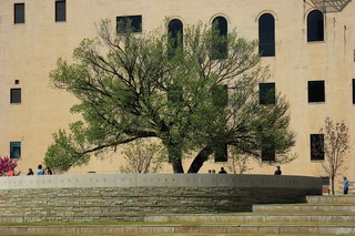 The Survivor Tree
The Survivor Tree, an American Elm, bears witness to the violence of April 19 and now stands as a profound symbol of human resilience. The circular promontory surrounding the tree offers a place for gathering and viewing the memorial.
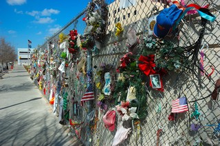
The Fence
What started as a protective barrier for the destructed site became a symbol of support and hope as people from around the world left notes, stuffed animals, wreaths and other momentos after the bombing. A 200-foot section of the fence now sits on the "healing" Western side of the Outdoor Symbolic Memorial, and visitors still leave items on a daily basis.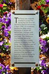
The Memorial Museum takes visitors on a chronological, self-guided tour through the story of April 19, 1995, and the days, weeks, months and years that followed the bombing of Oklahoma City's Alfred P. Murrah Federal Building. 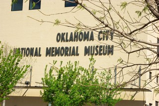
Day 17 - Sunday, March 18, 2007
Robert S. Kerr Reservoir Oklahoma to Oklahoma City, Oklahoma — 183 Miles
We again were slow to rise on Sunday but we finally got our things together and headed out of the state park and on to Oklahoma City. We seem to be leaving things behind … this time we could not find Lucy’s leash. After a final check of the campsite Sylvia found it under the pile of firewood. Again, other than the strong Oklahoma winds, this leg of the trip was uneventful, thank goodness!
As you can imagine we spend many hours these past months planning out this trip. We were planning on visiting Oklahoma and our family. We now were here to do this but also to take my mom into her final resting place in the Purcell, Oklahoma Hillside Cemetery.
Day 16 - Saturday, March 17, 2007
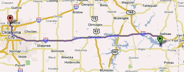
Memphis, TN to Robert S. Kerr Reservoir, Oklahoma — 322 Miles
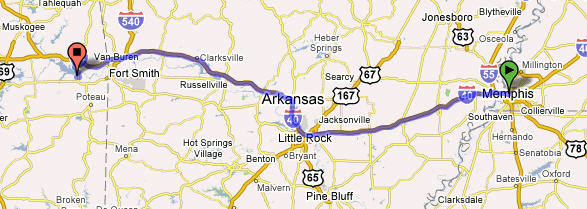
We left Memphis, TN later in the morning on Saturday. The long and quick trip was starting to take its toll on our bodies; however, we pushed on and did another long day of driving across Arkansas into Oklahoma. The rain was gone but replaced by very strong head and cross winds ranging from 20–30 mph. These winds were very changing when you are driving a non-aerodynamic bus-like vehicle. The winds blew me all over the road as I tried to maintain control. I would note at times that cars coming up behind me would lag back for some time before they would take the risk and quickly pass me. This leg was uneventful except for the winds. We looked at our camping books as we approached Oklahoma to try to find a good place to make a camp for the night.
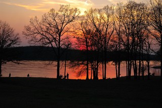
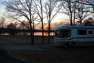 We found a beautiful site at the Oklahoma State Park at the Robert S. Kerr Reservoir close to Salisaw, Oklahoma. We got there just before sunset and found the park almost deserted; only 3 other campers in the whole place.
I built a great big campfire after gathering a lot of wood. Sylvia and had a wonderful evening sitting around the fire warming ourselves in very cool Oklahoma evening. The quiet peaceful evening was disturbed by some howling in the far distance. We called Lucy’s attention to it…I thought it may of been coyotes. After listening to the sound for a while, Lucy headed straight for the coach…She said she was a suburban dog. She did not want to have anything to do with these animals…. Sylvia soon was falling asleep in her chair and finally retired to the coach for the night the rocky journey had taken it’s toll on her. I sat around the fire a bit longer mesmerized by the warm flames as I thought about our journey thus far. I soon followed Sylvia to the coach for the night after putting out the fire with a lot of water.
Day 15 - Friday, March 16, 2007
Birmingham, AL
We woke early in the parking lot of Wal-Mart and began preparations to leave. We had parked in a very open section of the parking lot; however, that morning a tour bus pulled in as we were preparing to leave and immediately a bunch of cars began to come out of nowhere and parked all around to get on board the bus. The problem was that they were parking in the rows just in front of the coach and they were quickly beginning to box me in such that if I had wait a few more minutes I would not have been able to get out. I quickly completed preparations and got out of there! Guess you get what you pay for! We found a tire shop across the street where I took my now flat spare tire in for examination and repair. The guys in the shop were very friendly and most helpful; they found that I had a nail in the tire and they actually fixed it and did not charge me a penny for the repair!!
We also found an RV repair shop about 20 miles out of our way to have my faulty stabilizer alarm checked out. The shop found the problem was that the hydraulic fluid was low and this was what the alarm was trying to tell me. Once the fluid was topped off it fixed the problem. However, the mechanic had a heck of a time getting getting the fluid in there – so even if I figured it out I would have had to take it to a shop. We were off on our final leg towards Oklahoma City.
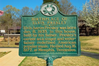
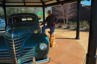
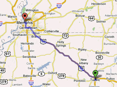
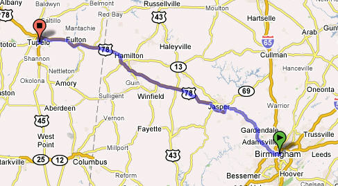 This leg took us through Tupelo, MS and then on to Memphis, TN. We had to stop in Tupelo since this was the birthplace of Elvis Presley. We got fuel, unhooked our Honda CRV and set off to find Elvis birthplace. Tupelo is a very small place and so we had no problem finding it. It was hard to believe that his birth house was actually smaller than our motor home!
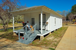
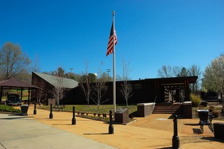
There was a museum and chapel at the site along with a few bronze statues and one of his automobiles.
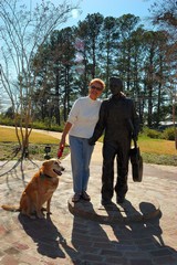 According to the information provided Elvis left the house when he was 13 years of age, after his Dad packed everything they owned into a 39 Plymouth heading for Memphis. After a short visit, we returned to the RV, hooked up the CRV and were back on the road again. This leg took us to Memphis, TN
where we spent the night at the Memphis Naval Support Facility.
Day 14 - Thursday, March 15, 2007
Charleston, SC to Birmingham, AL — 461 Miles
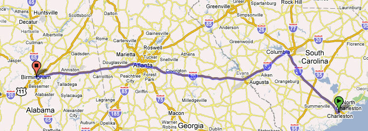
This was our first leg of our trip to Oklahoma City, OK. It was quite a long leg, especially since much of it was driven in the rain. The start was not without incident! We prepared to leave the campsite at the Charleston AFB. The preparation was the same as always — unhook from the water and electricity, move in the living room slide extension, lower the TV antenna, and raise the hydraulic stabilizers. The challenge came when I noted that the alarm light for the hydraulic stabilizers indicated that they were still down! I got out of the coach (of course it was raining),and checked under the coach noted the stabilizers were actually up; however, when I began to drive away the loud audio alarm and visual flashing red light began alerting me to the fact that they were still down and I should not drive. We made the command decision to drive anyway as it was obviously a false alarm . The RV manual did not have anything listed on stabilizers since all individual components come with their own warranty booklets. (That figures). The light and audio alarm went out after I drove a little ways but I was still concerned when the alarms would come on periodically as we drove toward Birmingham! We decided that we would have this checked out in Birmingham before we began our next leg. This stabilizer debacle took 1 1/2 hours from our departure time, which of course was Odark:30.
Little did we know more excitement was in store for us on this travel day. As we drove, we would periodically call my brother Glenn and his wife Cindy on their cell phone since they were traveling the same route through Birmingham and on to their home in San Marcos, Texas. Of course they left much earlier and we expected them to be way ahead of us after our debacle. Outside of Atlanta my brother had trouble with the charging system in his truck and had to replace his battery thinking this would fix the problem. However, around Anniston, AL he called saying he was again having problems and want us to meet up so I could take him to purchase a replacement alternator. We made the connection, replaced the alternator and were off on the road again. We planned to have dinner with them in Birmingham then or ways would part.
Not more than a couple exits down the interstate my brother noticed that my right rear outside dual tire looked a little low. Cindy called us and we pulled off to check it out at the Anniston Army Depot exit.
You guessed it!!! We had a FLAT tire and guess who was not happy!! I was prepared with my FMCA Road Service card and immediately called for help. A couple hours later the road service arrived and changed my tire in the driving rain. Cindy and Glenn stayed with us and helped us pass the time. With the tire changed we were off again finally arriving in Birmingham after dark; we looked for and found the Super Wal-Mart where we spent the night uneventfully, whew!
Day 9 - Saturday, March 10, 2007
Kingsbay Naval Base, GA to Charleston, SC — 208 Miles
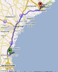 On Saturday we left KingsBay Naval Base, GA and drove to Charleston, SC where we met with my brothers from Alabama and Texas and my sister from Charleston to take care of the affairs of my mom.
While in Charleston we suspended posting of our blog due to the serious and sad task at hand. We spent 5 days in Charleston and left on March 15, 2007 to drive to Oklahoma City.
Day 8 - Friday, March 9, 2007
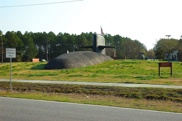
Kingsbay Naval Submarine Base
It was such a long drive from Tampa, Fl to Kingsbay Naval Submarine Base on Thursday that we decided to spend another day at this very nice campground. The entrance to the base was really interesting as you can see below. This is what we saw…. a submarine appearing to surface through the ground!! Really cool!
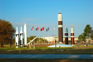
Going to the campground we passed by a display of some of the missiles loaded on some of the submarines.
The campground was really new with each site having a concrete pad that was level with full hookups including cable TV. While there the extra day we took the opportunity to take the ferry from St. Mary’s, GA to Cumberland Island National Seashore.
St. Marys, GA to Cumberland Island National Seashore

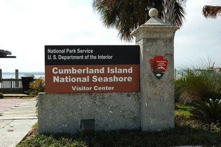
Cumberland Island is Georgia's largest and southernmost barrier island. Pristine maritime forests, undeveloped beaches and wide marshes whisper the stories of both man and nature. Cumberland Island is one of the largest undeveloped barrier islands in the world. The island has one of the largest maritime forests remaining in the United States and one of the largest wilderness areas in a National Seashore on the east coast. With 17-1/2 miles of clean sand beaches and 19,565 acres to explore (the park covers 36,415 acres of which almost half is marsh) the remoteness and visitor restrictions make this a unique place to visit. One of the oldest barrier islands on the Atlantic Coast and with a landmass larger than Manhattan Island, Cumberland Island National Seashore is blessed with rich soil and a number of ecosystems within the confines of its shores. You read a short history of the seashore at: http://www.outdoorplaces.com/Destination/USNP/gacumisl/
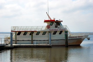 The ferry took about 45–50 minutes. We were escorted by two Dolphins froliken in the wake, much to the passengers delight. Once there we were met by a National Parks Ranger who gave us quick history lesson about the seashore and how it came into the hands of the National Parks Service, a really interesting story.
 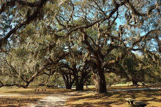 There were huge Live Oak trees all over the island; many were over 300 years old. It’s hard to get a real perspective of how large these trees really are from just looking at this picture; however, trust me they were huge!
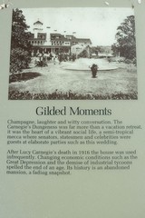
In 1880 Thomas Carnegie bought most of Cumberland and built the largest mansion ever to be located on the island. The 59 room Scottish castle completed with turrets, a pool house, 40 outbuildings, golf course, acres of manicured gardens and a squash court must have look incredibly out of place on the Georgia Coast. The mansion was used as a retreat through 1959 when it too burned to the ground. 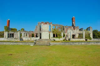
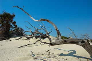 We walked around a little and tried to get to the other side of the island to see the seashore itself; however, we ran out of time and only got to the sand dunes before we had to turn back to be able to catch the ferry back to St. Marys.
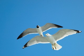 Lots of sea gulls followed as we ferry’d back to St. Marys.
